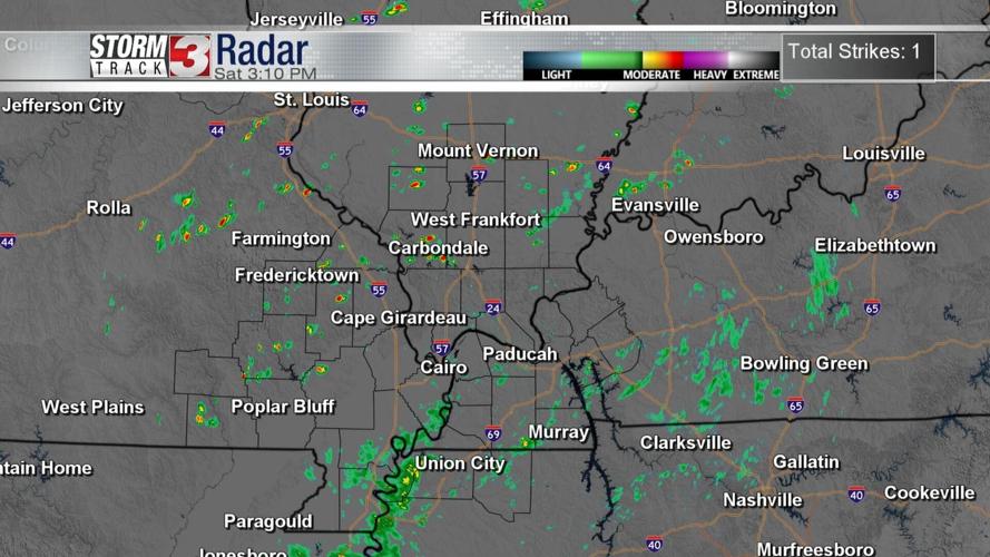
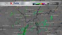


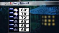


WSIL (Carterville) -- The wet and muggy pattern has returned to the region as a low pressure to our south funnels up Gulf moisture. Although temperatures are in the low 80s, it feels pretty uncomfortable outside. Scattered showers are expected, with it picking up more during the heat of the day.

Nothing too severe is expected, but it can definitely ruin some outdoor plans. Localized flooding and lightning are the biggest risks to keep an eye on. No need to cancel anything today, tomorrow may be a different story.

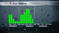
Overnight chances diminish and temperatures drop into the mid to upper 60s.

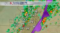
Beginning early morning, the rain chances will return but it'll be thanks to a frontal boundary moving in from the northwest. Tomorrow, winds will shift from the west and be a bit stronger. The rain will also be a more widespread event in the afternoon compared to today.
Again, nothing too severe is expected, but the risk of lightning along with localized flooding with those heavy pockets of rain remains an issue. If you plan to attend any games, fairs or memorial events, make sure to have a backup plan and continue to check the weather.

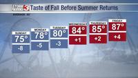
The good news for fall lovers is that thanks to the front coming through tomorrow, our temperatures and dew points will fall, making for a beautiful Monday and Tuesday. Tomorrow is also our last chance for wet weather for a while.