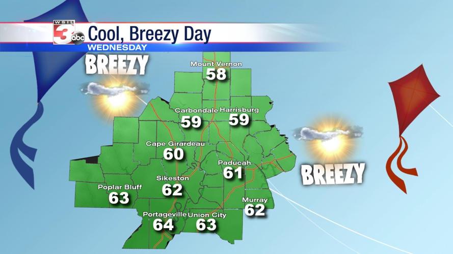


CARTERVILLE (WSIL) �� Brrr! Behind the cold front, winds have turned out of the northwest and it’s become quite breezy.
High pressure will gradually build in from the west on Wednesday. Outside a few fair weather clouds around lunch time, we’ll enjoy plenty of sunshine, but it will be a cool, blustery afternoon. Wind gusts could blow as high as 20 to 25 miles per hour.
Tonight, high pressure moves closer to the region, so winds will begin to relax. That could lead to patchy light frost developing early Thursday morning.
By Friday, high pressure is east of our region and the south wind will help bring temperatures back closer to 70s.
A weak disturbance Saturday could spawn a few showers in the afternoon, but for the most part, the weekend will be dry for many in the region.
Another strong cold front is expected next Monday with some potential for heavy rain and a few stronger storms. It’s something meteorologist Nick Hausen is tracking on News 3.