


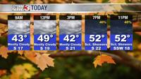


WSIL (Carterville) -- We have a windy and cloudy day ahead of us for our Friday. Waking up temperatures are in the mid 30s, much warmer than this time yesterday. Winds will begin to pick up out of the south in the next few hours. Highs will also be much warmer compared to yesterday, climbing into the low 50s.

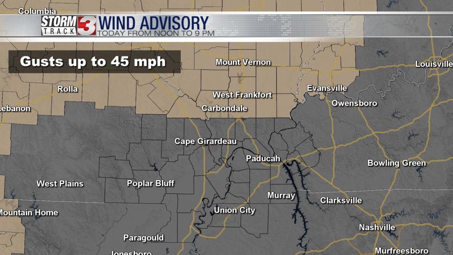
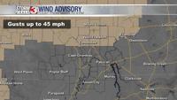
If your Storm Track 3 app went off yesterday that's thanks to a Wind Advisory that's in place for our northern most southern Illinois counties with cities including Carbondale, Mount Vernon, Harrisburg and West Frankfort. Winds today will be in the 20-25 mph range with gusts upwards to 45 mph.

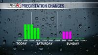
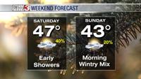
A strong cold front is still expected to pass through tonight dropping our temperatures and bringing a chance of scattered showers. No major rain totals or severe weather is expected from this. A few of those showers may linger into early tomorrow but most of Saturday should be dry.

Sunday is the day to keep an eye on. There's model disagreement but an isolated wintry mix chance may be possible between 6 AM and noon. No major travel impact or accumulations are expected at this time but it could change since we're still 48 hours out. If you have to be out early, give yourself a little extra time.

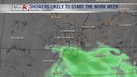
The unsettled pattern continues into the work week with a chance of showers still expected. Currently rain totals have significantly dropped but we'll continue to keep tracking and updating.