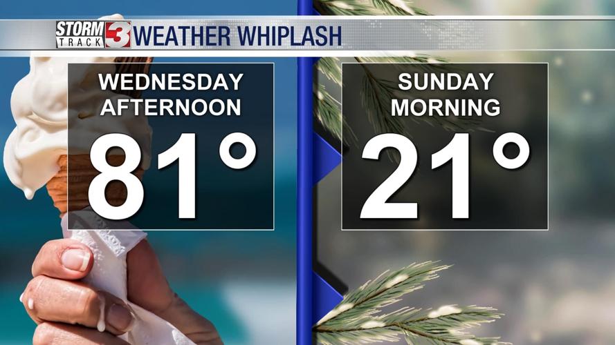


WSIL (Carterville) -- A much different pattern has moved in today thanks to a passing cold front from this morning. We've already hit our highs today in the upper 40s, lower 50s so we'll spend the evening continuing to drop. Winds are quite strong from the northwest this afternoon with gusts 25-30 miles per hour possible.

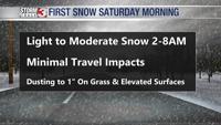
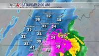
We're still continuing to track the chance for light snow showers overnight for most of the region. An increase in the amount of moisture has also been a notable trend. Our current thinking is that light snow will make it's way into most of the region after midnight and through much of the early morning hours Saturday.

While a few burst of heavy snow are possible, very warm ground temperatures will likely keep accumulations minimal and mainly only grass and elevated surfaces. Travel impacts are not likely at this point.

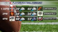
By 8 AM Saturday, snow will be exiting eastward, but a cold, bluster, winter-like day is expected. High temperatures Saturday afternoon will only be around 40º, but the wind will make it feel a lot colder with wind chills in the upper 20s and lower 30s. Should be dry for the local playoff games across the region but you'll need to bundle up.
We stay in the cold rut for quite some time. Another chance for winter weather is possible late Monday night and into Tuesday.