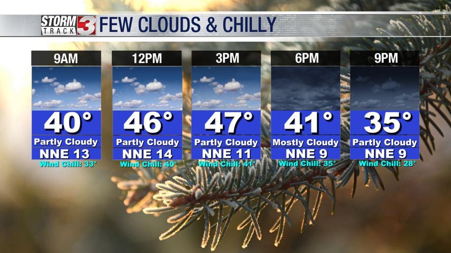


WSIL (Carterville) -- It's another chilly start to the day but at least warmer than yesterday. If you're be grabbing any of those door busting deals, make sure to grab a warm jacket.
Into this afternoon highs will climb back into the mid 40s and for areas south of Paducah, low 50s. Clouds will hang around throughout today and into Saturday.
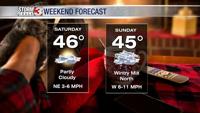
Tomorrow will be very similar to today in temperatures and overall conditions.

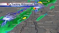
Sunday will continue to be a day to keep an eye on. The next weather maker will sweep the region bringing the next chance of precipitation, key word precipitation. It's all going to depend on if that cold air can move in further south.
There is a chance for the first snowflakes of the season for areas north of route 13. Luckily even if we do end up seeing a wintry mix, it'll be a low impact event because we won't see anything measurable.