


WSIL (Carterville) -- Between Friday and Sunday, our region received 128 warnings varying between severe thunderstorm, tornado and flooding. That's the most activity in the 3 day period since 1995. Monday has never looked so good with today being the best day of the week and a nice reprieve from this weekend.

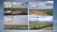
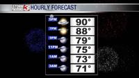
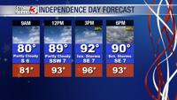
Highs are fairly average for early July in the upper 80s, low 90s. Blue skies are peaking through large cumulus clouds. We remain dry for the rest of our day and you should be good to go for any Independence Day activities that you may have planned for today. Overnight we remain quiet, falling into the low 70s.

Tomorrow is a bit warmer than today but the bigger focus is the chance of rain returning. Into the late afternoon and evening, pop-up storms become more likely. You may need a back-up plan for your outdoor plans after 4 PM.

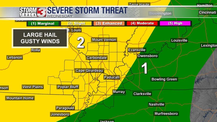
Wednesday seems to be the day to watch with severe chances returning to the region. During the day, heat and humidity will fuel some more pop-up storms similar to Tuesday. It won't be something everyone sees. The severe risk really moves in later that night thanks to a cold front.
We have a 2 out of 5, slight risk for almost everyone. Biggest threat to watch out for are large hail and strong winds. A few supercells can't be ruled out either.
A few showers may linger into early Thursday.

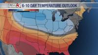
Later in the week we're trending cool as far as July goes. Highs will stick around the upper 80s.