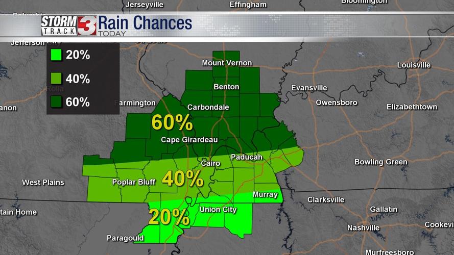
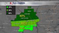

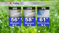

WSIL -- Pack the rain gear! Showers to start the day are leading to a wet morning!
Scattered showers are tracking from the west to the east as an area of low pressure passes to our south.

Rain will wrap up by mid to late morning, but clouds will linger around and temperatures will stay cool.

Many topped 70º back on Monday, but much of the region will struggle to get much above 60º today.
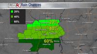
Another wave of showers is expected Wednesday morning. Initially, we expected these to remain south of our region, but there's more hints a few may make it into the Missouri Bootheel and western Kentucky.

The 7 and 10 forecast is filled with cool weather. The coldest morning is likely to come Thursday, as temperatures bottom in the upper 30s.
While widespread frost is unlikely, a few patches of light frost can't be ruled out in rural, outlying areas.