


WSIL -- You may need a jacket this morning as temperatures have dropped back into the upper 40s. A little sunshine early will quickly be covered up with clouds as a warm front begins lifting northward.

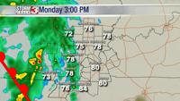
Despite the clouds, temperatures will still warm into the upper 70s this afternoon with a few in Kentucky and the Bootheel creeping into the lower 80s.

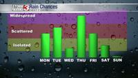
Rain will increase towards mid-afternoon across southeast Missouri and then move into southern Illinois and western Kentucky by late afternoon.
Showers and isolated t-storms will remain likely overnight. Pockets of heavy rain and even a strong storms or two is possible.
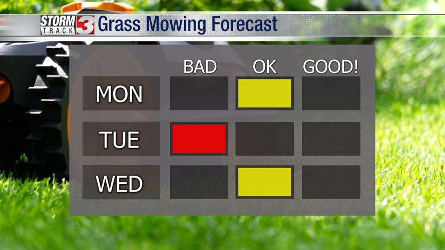
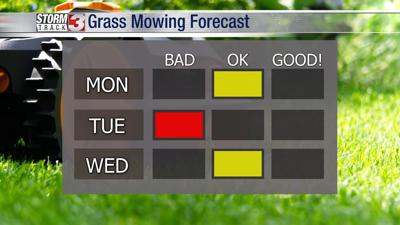
A lull in the rain is expected by mid-morning Tuesday, but as a cold front moves in from the north, showers and isolated t-storms are likely to redevelop.

Wednesday brings a mostly dry, but cooler day. As another system tracks into the Midwest, rain and storm chances return Thursday.