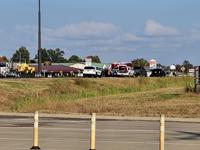

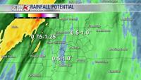


CARTERVILLE, Ill. (WSIL) -- A line of heavy showers and thunderstorms continue to move through much of the region this early afternoon.
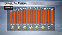
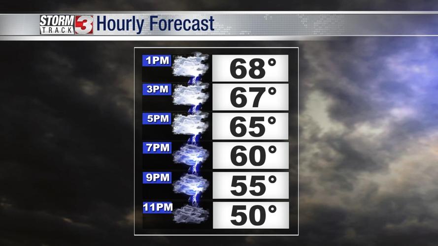
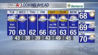
This afternoon and going into the evening, showers and storms will continue to push east and northeast. Most of the heavy rain should be out of the region by late afternoon with lingering showers expected into the evening and into midnight hours Wednesday. High temperatures peaked into the upper 60's and lower 70's.

Wednesday: Not as cool and not as warm as what it has been. Morning lows will be into the mid and upper 40's. A few lingering clouds in the morning and should be out by the late morning hours. Partly cloudy. High: 63. Low: 38.
Thursday: A clear overnight and morning will lead to cooler morning lows into the mid 30's to lower 40's. High: 64. A few clouds will build into the region. Winds from the NW will continue to drive cooler air.

The next chance of rain seems to be the weekend.