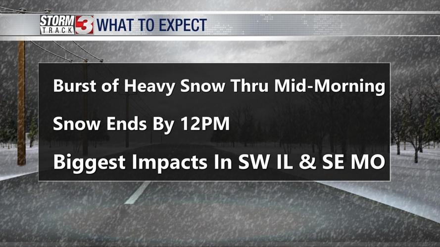
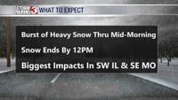

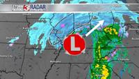


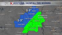


WSIL -- Low pressure is tracking right up the Ohio River with heavier snow falling to the northwest across southeast Missouri and southwest Illinois. Snow will continue in these areas through mid to late morning with an additional 1-3" possible.

Closer to the low, more rain is mixing in across southeast Illinois and western Kentucky. These areas are unlikely to pick up much in the way of additional snow accumulation.
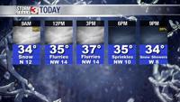
Snow will end by 12 p.m., though a few flurries remain possible during the afternoon. Temperatures will stay above freezing, which should lead to drastic road improvements once the snow wraps up.

As the back side of this storm system swings through, a few more snow showers are possible tonight, mainly after 9 p.m.
As temperatures dip into the upper 20s overnight, some re-freezing is possible, especially on untreated pavement such as parking lots and sidewalks.
Thursday will be a cold, blustery day with highs only in the lower 30s.
Warmer weather quickly moves back in on Friday with highs jumping into the 40s, and by Saturday, temperatures will warm to around 50.