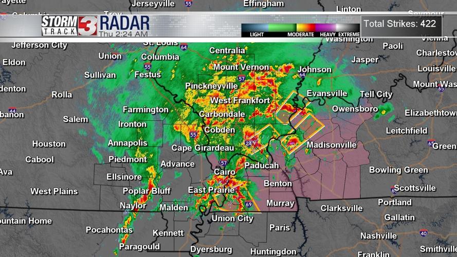


WSIL (Carterville) -- It's been an active morning on radar already thanks to a surface low that's pushing a cold front through the region. Many are waking up to the loud rumbles of thunder thanks to active lightning, along with sirens.
We've had quite a few Severe Thunderstorm Warnings this morning. A Severe Thunderstorm Watch has also been issued until 5 AM for parts of Western Kentucky and Southern Illinois.
The largest threat we're still tracking with this large hail, gusty winds and heavy rain but a spin up tornado can't entirely be ruled out as we've already seen with one tornado warning.

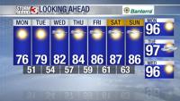
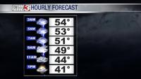
We'll continue to track the possibility of storms until mid-morning before it switches over to rain for the early afternoon. Temperatures are still mild now but once the cold front moves through, we'll quickly see it cool down by the evening.

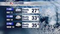
Much cooler air is moving in and sticking around for our Friday. Waking up temperatures will be in the upper 20s and highs in the mid to upper 30s. A few flurries may also be possible. The cold weather is short lived as we'll be unseasonably warm again in just a few days.