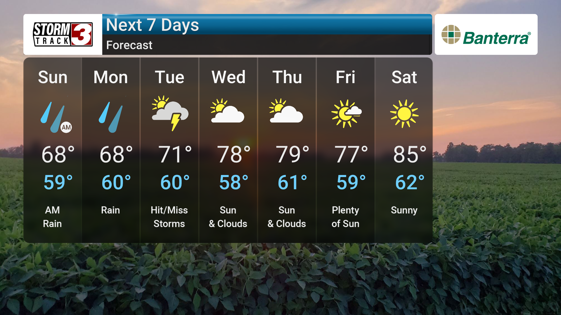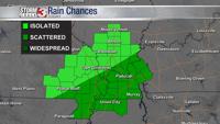

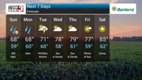
Carterville, IL - Memorial Day weekend is off to a damp and cool start across the Quad State area, with persistent cloud cover, scattered showers, and the occasional rumble of thunder expected through Tuesday. The long weekend’s weather will be far from poolside-perfect—but it's not all bad news.
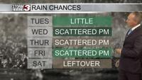
A nearly stationary front draped to our south is the primary driver behind this spell of gloomy weather. Moisture riding up and over the boundary is fueling waves of rain and isolated storms. The heaviest rainfall amounts, projected near 2 inches by Tuesday, should remain across the Missouri Bootheel and western Kentucky.
Despite a few rogue cells potentially flaring up, the core threat of organized severe weather is expected to stay further southwest. However, forecasters aren't ruling out a stray strong thunderstorm, particularly Monday night into Tuesday.
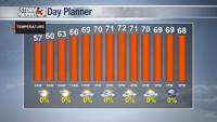
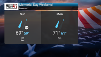
The most noticeable feature for residents this weekend may actually be the chill in the air. With thick clouds and steady easterly winds, highs are stuck in the upper 60s to low 70s. On Memorial Day itself, highs may struggle to crack 66°F. Humidity will creep up gradually, but full-on summerlike conditions will be delayed until next weekend.