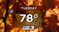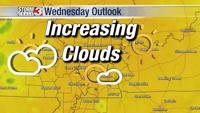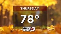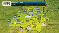


A brief stretch of quiet weather is setting up across Southern Illinois, but eyes are on a developing system that could bring a stormy finish to the week. Wednesday brings a pleasant mix of sun and clouds with highs reaching the mid-80s and light southerly winds. Thursday follows suit temperature-wise but with increasing cloud cover throughout the day as moisture begins to build ahead of an approaching front.
The first round of thunderstorms is expected Friday afternoon into the evening as a system moves into the lower Midwest. Friday morning may start off dry, but activity is expected to increase by mid-afternoon, with scattered thunderstorms likely through the evening commute.
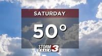
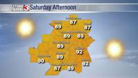
Storm chances continue into Saturday, with the greatest window for activity expected between late morning and early evening. There will be breaks of sunshine at times, but enough instability remains in place to support continued development.
Sunday looks a bit quieter, though a stray shower or storm could still pop up—especially in the afternoon. Monday may begin with lingering showers before skies gradually turn mostly cloudy later in the day.
While no widespread severe weather is anticipated at this time, we’re closely monitoring the strength and timing of this system. Into next week, signs point to a drier and warmer pattern developing once again.