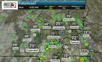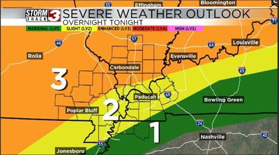


Carterville (WSIL) -- Much of our area today is in a level 2 or 3 risk for severe weather. The main concern looks to be damaging straight line winds as we could have some bowing clusters of thunderstorms move through around 12-2AM. There is also a risk for some quick spin up tornados with some of these line segments but the risk for significant tornado activity looks generally low. Some of these storms could also have some hail in them probably up to quarter sized being the biggest we see.
The situation is evolving throughout the day and many things can change so make sure you're tuning into WSIL this evening for the latest on the set up.
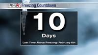
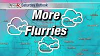
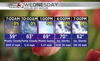
After this storm moves out I expect temperatures to get really cold especially for Wednesday when we could have showers around with gusty winds and temperatures in the 40s.