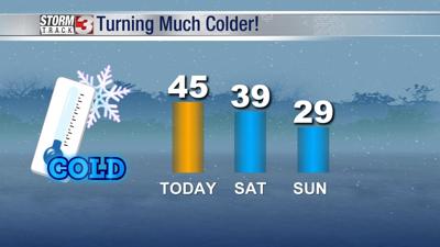
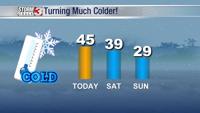
WSIL -- Cold and crisp morning as water on the grass has frozen overnight. Temperatures have dipped into the mid 20s and wind chills are dropping at times down to around 20º.
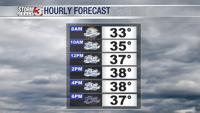
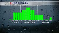
Plenty of sunshine is expected Friday and you may want to enjoy it because we likely won't see much through at least the middle of next week. Sunshine will help bring temperatures back into the mid 40s, also one of the warmest temperatures in our forecast.
A fast moving system known as an Alberta Clipper could bring a few snow flurries along the I-64 corridor, but accumulation is unlikely.
A stronger system Saturday evening brings potential for a little more winter weather. Rain will spread in Saturday afternoon and quickly change to snow across southern Illinois and southeast Missouri. Accumulations will likley not be much, but an inch on grass is possible by Saturday night.
Join meteorologist Nick Hausen on News 3 to learn about a blast of Arctic air expected later this weekend! We've got you covered!