

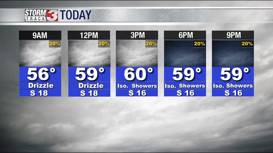
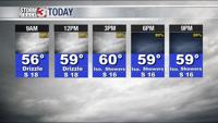

WSIL -- Remember just a week ago when temperatures were plummeting into the deep freeze? Well, that's a thing of the past as temperatures have remained steady in the lower to mid 50s overnight as strong winds ushered in warm, somewhat humid air.

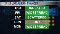
Patchy drizzle is possible this morning and a few isolated showers are possible this afternoon, but there will still be a lot of dry time Thursday. Strong south winds may gust over 30 miles per hour at times.
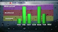
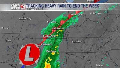
Tonight, a storm system will approach from the southwest, increasing rain chances. Widespread rain and occasional t-storms are expected through much of the day Friday. Some of the rain could be heavy, especially in southeast Missouri and southern Illinois. As a cold front cuts through the area Friday afternoon, temperatures in Illinois and Missouri will begin to drop back into the 40s, while mid 50s remain in Kentucky the Missouri Bootheel.

Showers will likely linger into at least Saturday morning. Minor flooding is possible in Illinois and Missouri where a few areas could pick up more than two inches.

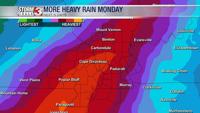
For those with New Year's Eve plans, temperatures are likely to be dropping back into the 40s by the evening, but rain will not be a factor. Dry weather sticks around into Sunday, but another strong storm system will bring more wet weather on Monday. There is potential for another round of heavy rain Monday night along with a threat for a few strong storms.