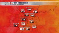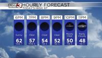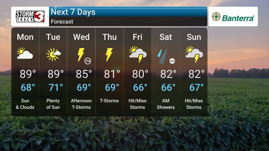


Good afternoon, everyone. Hazy skies from the Canadian wildfires will persist today into Monday. We'll be monitoring a slight chance, 20-30%, of thunderstorms this afternoon across southern parts of southeast Missouri, western Kentucky, and southern Illinois. While the severe weather threat remains low, a stray strong storm or two could produce gusty winds and small hail. We will be monitoring these storms closely.
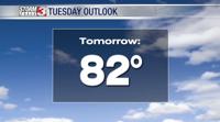
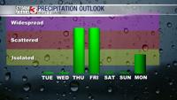
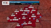
Looking ahead, additional chances of showers and thunderstorms return Wednesday and continue through Saturday. Temperatures will climb to the upper 80s Monday and Tuesday, about 5 degrees above normal for this time of year, with increasing humidity. Wednesday, scattered showers and thunderstorms are likely with a high of 83. Similar conditions are expected Thursday and Friday with highs near 80. Shower and thunderstorm chances persist into Saturday with a high near 80.
A stalled front is currently draped across the region, contributing to the development of some surface-based instability. Model soundings, however, indicate drier air aloft, which may limit thunderstorm coverage. While severe weather is not expected to be widespread, we will be watching for any potential for stronger storms. The front will remain stalled over the area, which could lead to some patchy fog tonight over southeast Missouri and western Kentucky. A persistent southerly flow will bring an increase in heat and humidity to the region early next week before the next chance of more widespread rain arrives mid-week. We will be monitoring this period for any potential heavy rain or severe weather threat.