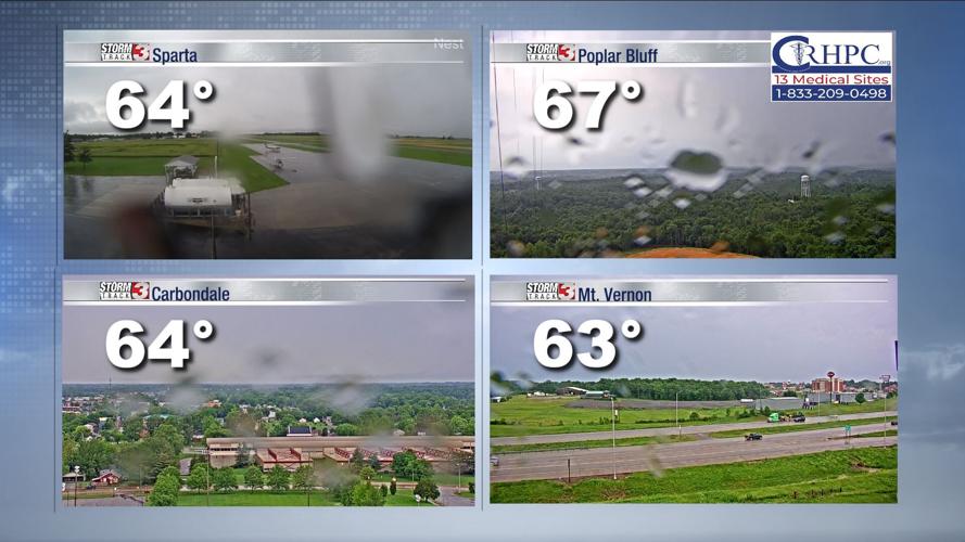


Carterville (WSIL) -- We're continuing to track storms as they make their way across the region which has quickly cooled us down.

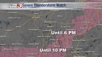
A Severe Thunderstorm Watch has been issued for parts of southeastern Illinois and western Kentucky until 6 PM. We have also seen Severe Thunderstorm Warnings in our region as well so important day to be weather aware.

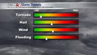
The largest threats for today are hail and strong winds/gusts, but a possible tornado can't be ruled out. So far we have seen some really heavy rain, lightning and strong winds. There have also been storm damage reports out of Illinois and Missouri.
The Storm Prediction Center has the majority of our region under a slight (2/5) risk. This system is one to keep an eye on through the afternoon and evening.

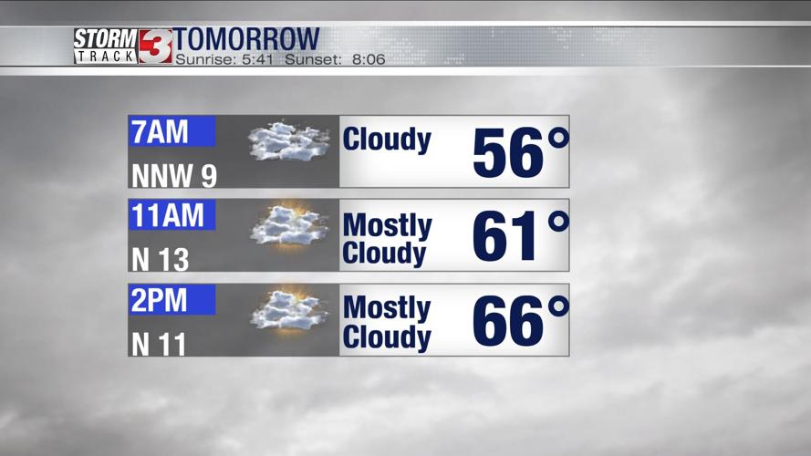
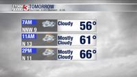
The rest of our weekend looks to be a bit drier but clouds will continue to stick around and temperatures are on the cool side thanks to today's cold front.
The work week has multiple chances for us to see some showers and thunderstorms.