


WSIL (Carterville) -- It's a chilly start to the day since we aren't seeing any clouds to help keep us warm. Temperatures are still mild for this time of the year, but you'll want a jacket for the mid 30s as you're headed out the door.
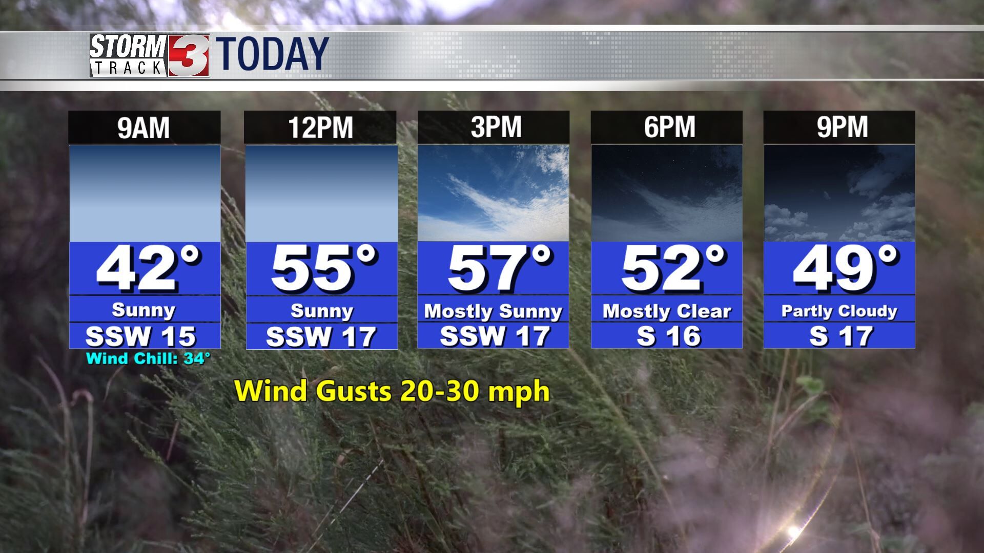
The cool morning won't set the tone for the rest of today with highs nearing 60 degrees. There will also be plenty of sunshine, making it the pick day of the week. Unfortunately we will be battling a strong wind gust out of the southwest upwards to 30 mph.
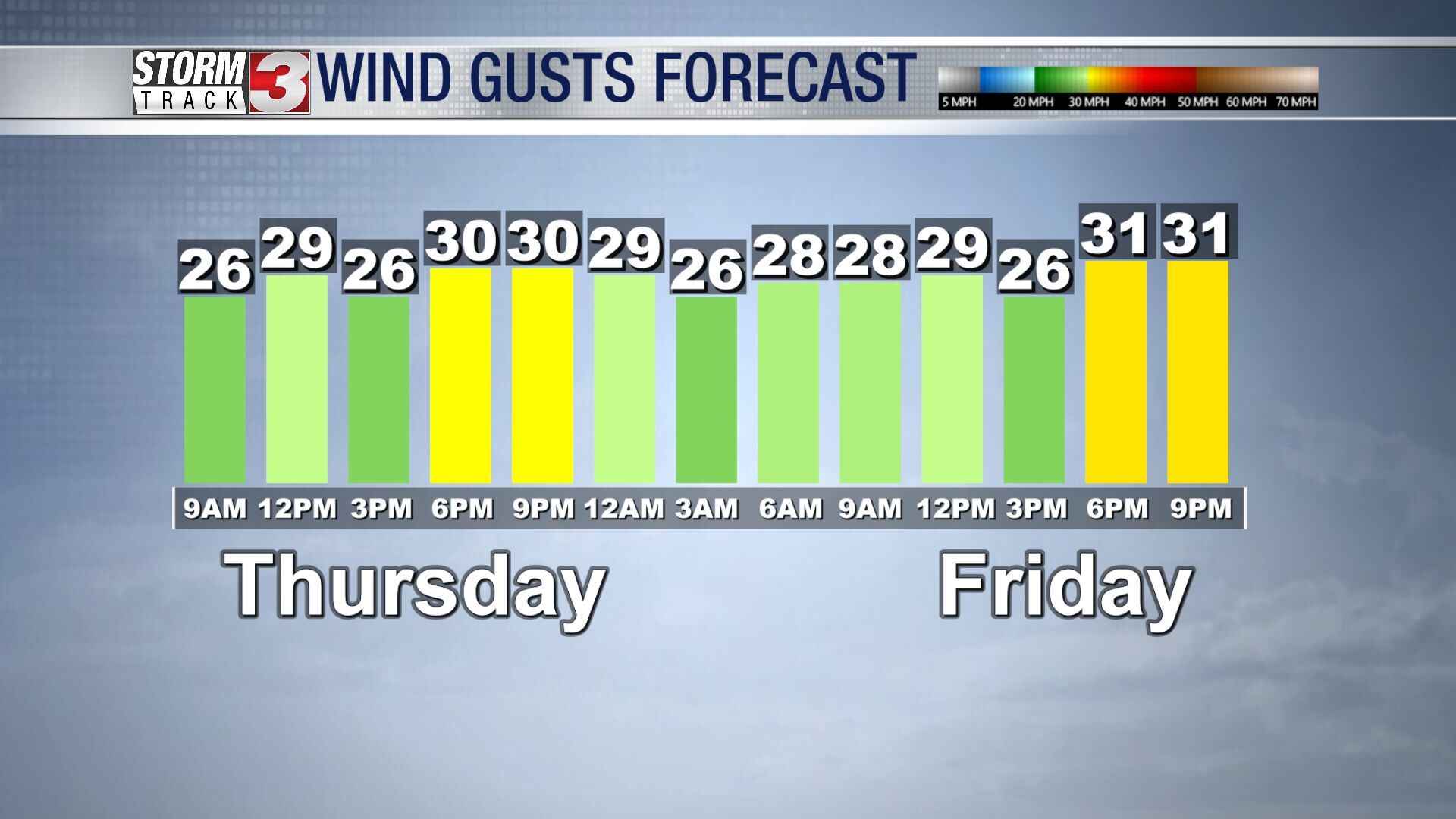
The winds will continue throughout our Friday thanks to the weekend disturbance pushing towards the region. Tomorrow will be similar to today temperature wise, but it will be cloudier.
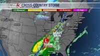
First chance of rain will move in late Friday but shouldn't impact your plans too bad. The better chance for showers will be throughout Friday. Totals continue to be 1 to 2 inches.
Lighter rainfall totals will be over southeastern Missouri and southern Illinois.
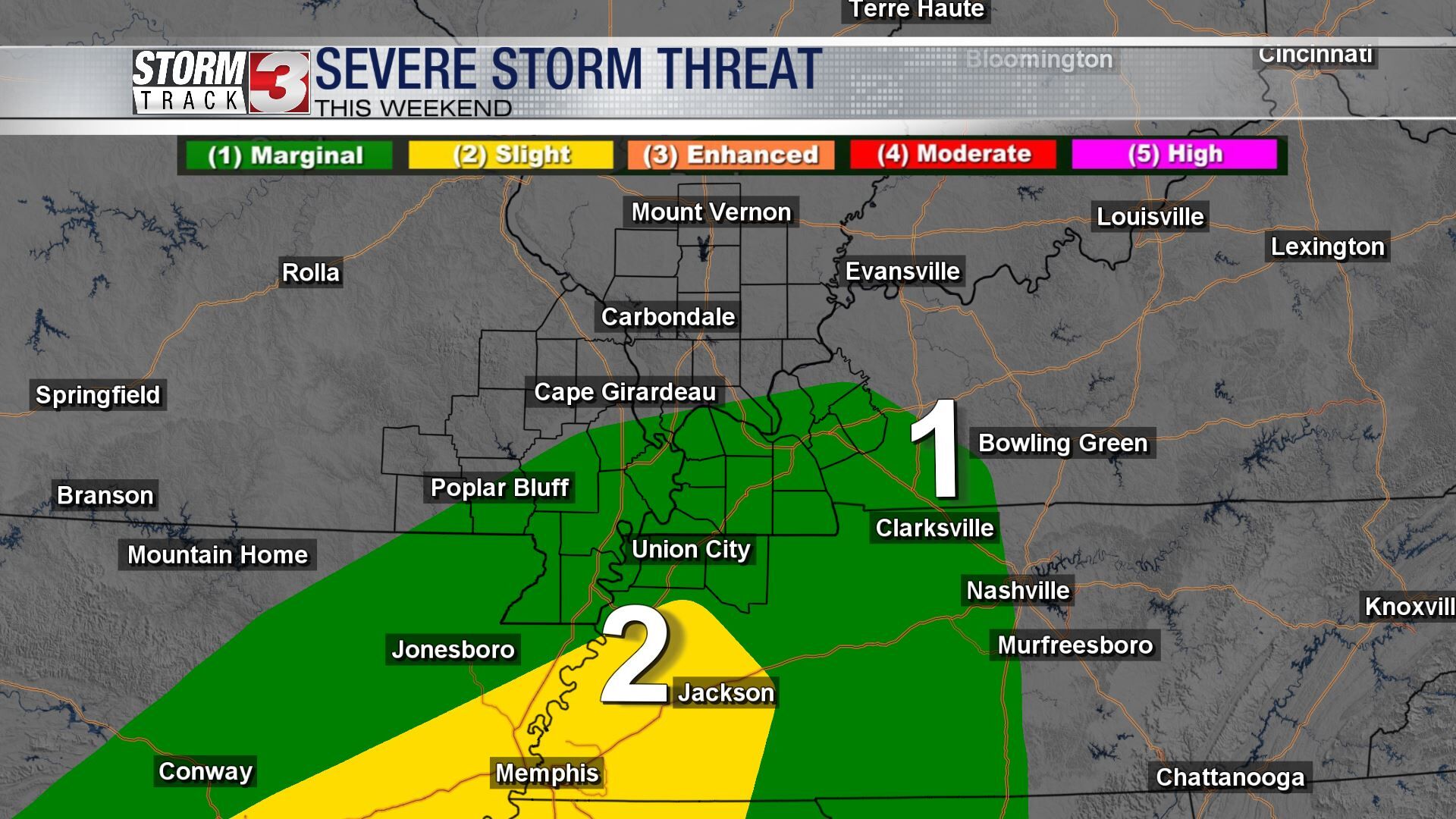
The Storm Prediction Center has now put an outlook in place for our region. Our southern most counties now have a Marginal (1 out of 5) risk for the possibility of severe weather, but the slight risk isn't much further south than we are.
If the low pressure moves any further north, we could see the risk become elevated for our region.
Sorry to snow lovers, but a wintry mix isn't looking likely for the weekend.