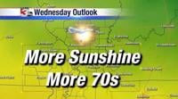
WSIL — Dry skies will stick around through Wednesday, but winds will start to pick up Wednesday afternoon as the next big storm system drops into the Plains.
That big storm system will bring blizzard conditions to the northern Plains and Upper Midwest. In our region, strong winds may gust to close to 40 miles per hour on Thursday afternoon. A line of showers and storms is expected to develop ahead of an approaching cold front late in the day Thursday. A few of these storms could be on the strong side with gusty winds and small hail possible.
Behind the cold front, the mercury plummets with Friday afternoon temperatures only in the upper 50s and lower 60s. Saturday morning, upper 30s are likely, though frost development looks spotty at best right now.
Chief meteorologist Jim Rasor will have the latest forecast coming up tonight on News 3!