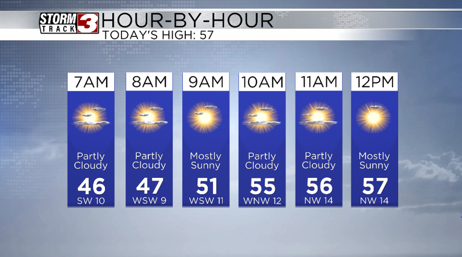


WSIL(Carterville, IL)--This morning, a lot of us are waking up to partly cloudy skies and temperatures in the mid to upper 40s. Wind are currently out of the southwest at 10 to 15 miles per hour.
Today, you can expect to see temperatures in the in the mid 50s by 9:00 AM and in the upper 50s this afternoon. We will see a few more clouds this morning, before skies turn mostly sunny in the afternoon. These clouds are associated with a dry cold front that will move through the area. This front will also bring the chance of gusty winds, which could be peaking at 20-25 miles per hour out of the northwest.
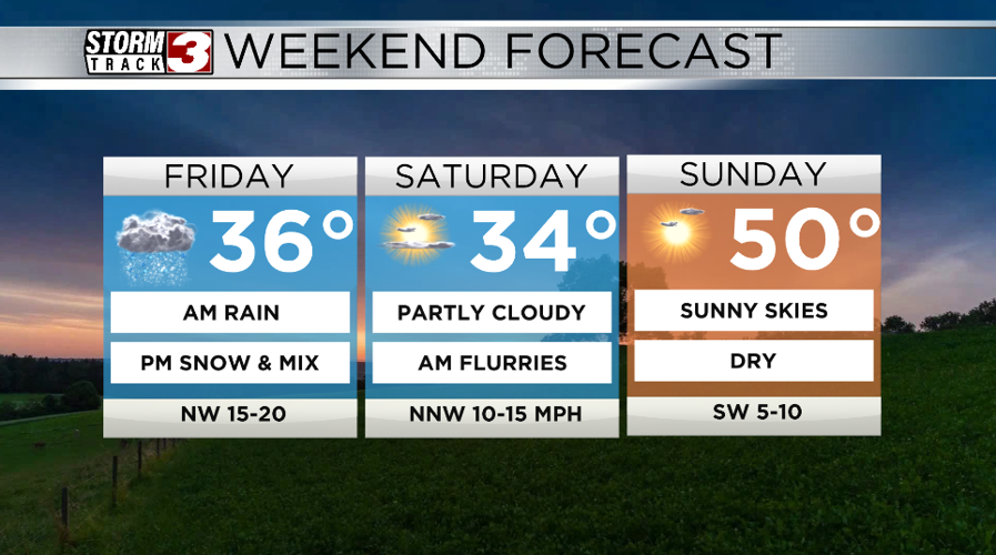
Tomorrow, we will see temperatures start in the mid 30s for the morning, before temperatures decrease slightly through the day. We have the chance of scattered to widespread showers early in the morning, and if temperatures cool enough we could see a brief change over from rain to a mix to snow. However, at this time, this change over should be quick, and no significant accumulations are expected.

The bigger impacts that will be felt with this system will be the colder temperatures that will set in for Saturday with lows in the lower 20s and highs in the lower 30s.
Temperatures will rebound into the 50s for Sunday, and early next week.