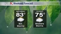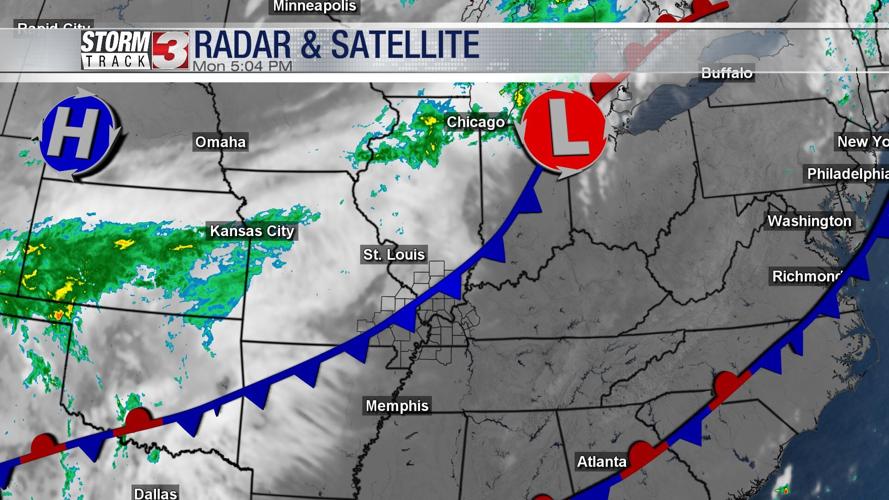

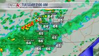


WSIL (Carterville) -- Despite the extra cloud cover, highs today are reaching the upper 70s, low 80s. Clouds moved in earlier today thanks to a cold front that's currently moving through the region. Isolated rain chances will begin around 10 PM tonight.

The bulk of the scattered showers will likely come during your morning commute so make sure to give yourself a bit of extra time. Good news is we aren't tracking anything severe or widespread. Tuesday is not expected to be a washout. Showers will subside into the second half of the day.

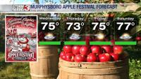
Behind the front, temperatures are much cooler with some days only reaching the low 70s! Despite fall being 12 days away, it'll feel like it this week.