

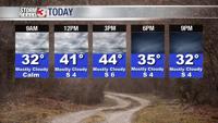


WSIL -- Cloudy and chilly, but Sunday will be dry with less wind than earlier in the weekend.

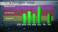
The pattern is much more active during the upcoming work week, resulting in multiple waves of rain.
Starting with a warm front lifting north late Sunday night, a few showers are possible in the Missouri Bootheel into early Monday morning.
By Monday afternoon, a cold front will be approaching from the northwest, bringing more widespread showers to much of the region Monday afternoon and evening.

This boundary will move back and forth several times through the week. Right now, the heaviest rain is expected Thursday. A few t-storms are possible Thursday afternoon and evening as a large storm system tracks through the Midwest.
By Friday, the cold front will be far enough south for a day of drier weather, but the boundary may return, bringing more wet weather during the weekend.

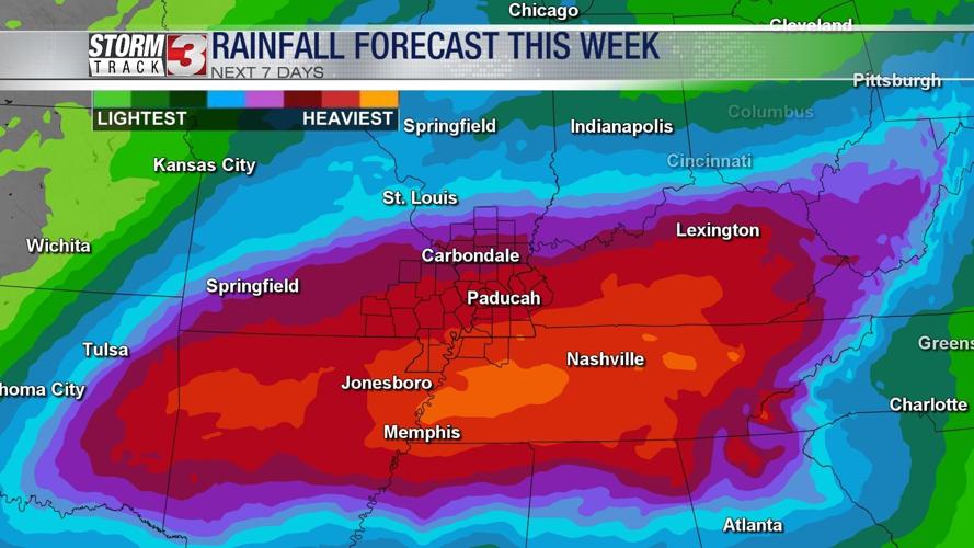
Rainfall amounts through the week will be heaviest in western Kentucky where 3-4" of rain are possible. Amounts will gradually get lower farther north, with 1-2" expected on the I-64 corridor in southern Illinois.