


CARTERVILLE, Ill. (WSIL) -- You may want to ditch the snow coat and exchange it for a rain jacket and umbrella! Mother nature is pulling a pattern flip!
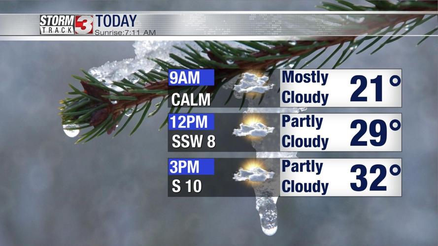
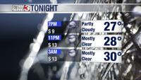
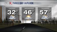
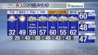
Tuesday: Mostly cloudy today and later becoming partly cloudy into the late afternoon. Temperatures reaching the lower to mid 30's and dipping back into the mid and upper 20's for the evening hours. This could cause another refreeze, causing some slick conditions going into Wednesday.

Wednesday: The change in temperatures should be noticed today! Temperatures will be cool in the morning, areas of ice, but eventually the temperatures will rise into the mid and upper 40's, with some areas to the south seeing the lower 50's! The winds will be coming from the south, bringing that warm air into the region. Clouds will come back into the region late afternoon as we look to track our next chance of rain.

Thursday: Mostly cloudy, temperatures will be warmer, into the lower and mid 40's. By the afternoon, a few isolated showers will be likely. Temperatures will reach into the mid and upper 50's with some areas reaching into the lower 50's!

There is a catch! As we enjoy some warmer temperatures going into the New Year, we will be tracking rain, heavy at times through most of the weekend!