


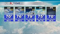


WSIL -- Quite a few clouds around this morning, but still mostly dry as a disturbance is still well to our southwest. Temperatures are in the low to mid 60s, so many may get by without a jacket.

An isolated shower or two is possible through the morning, but there will be a lot of dry time through midday.
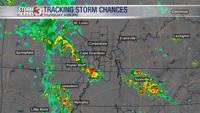
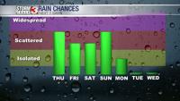
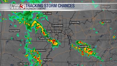
Later this afternoon, mainly after 3 p.m. showers and storms will be increasing. Starting in southeast Missouri, a band of storms is expected to track north and east through the late afternoon and evening, eventually shifting into southern Illinois and western Kentucky. The main threat will be heavy downpours and frequent lightning.

A few showers could linger overnight and into early Friday morning. By sunrise Friday, most will be seeing more dry time again.
The pattern from Friday afternoon and through the weekend is very "Florida-like". During the heat of the day, pop up showers and t-storms will develop, producing pockets of heavy rain and lightning. An isolated strong storm can not entirely be ruled out with hail and strong winds.
The next cold front will sag south Monday, shifting the humid air south, and also taking the rain chances south much of next week.


