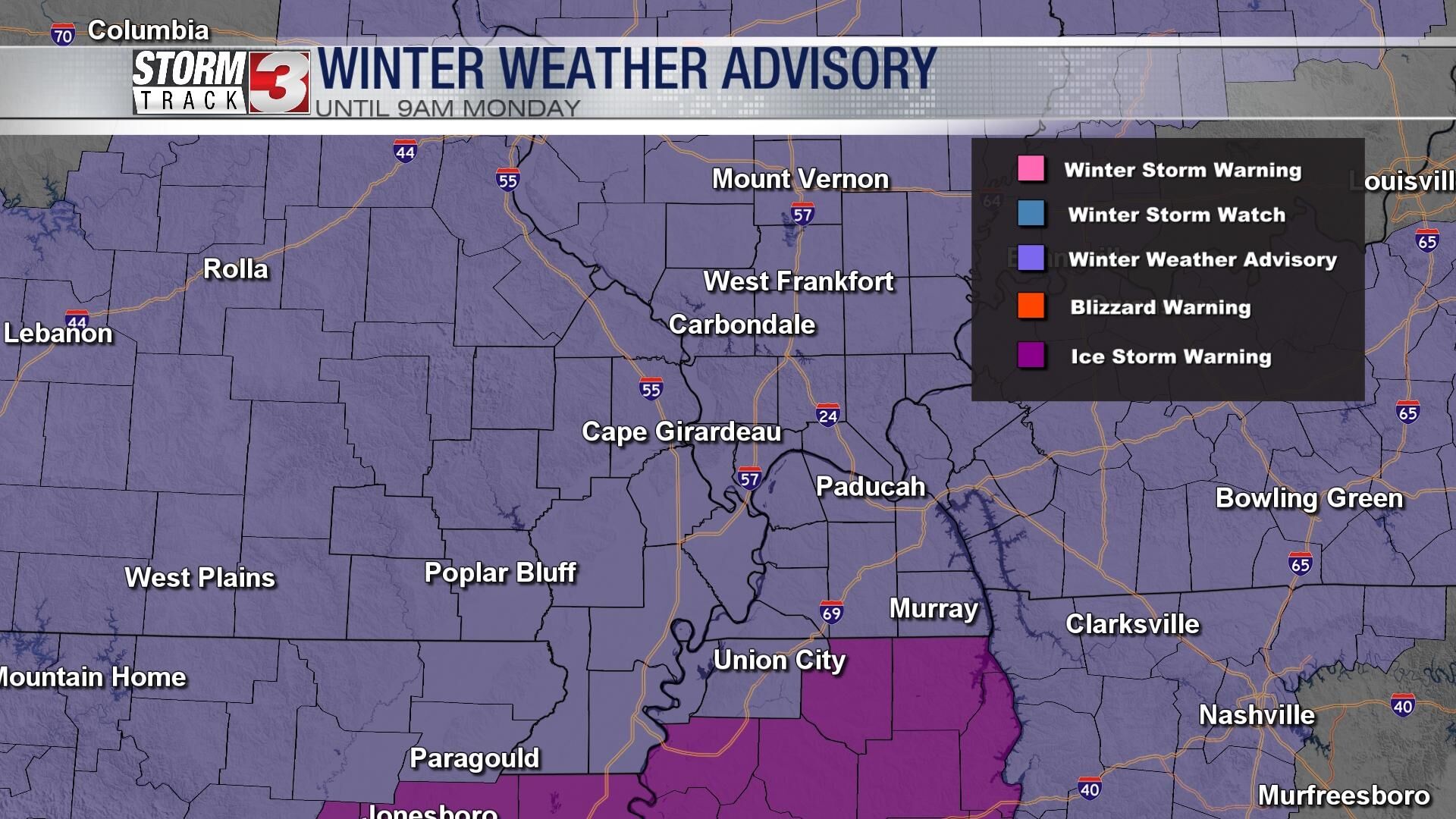
WSIL -- Light freezing rain is tracking across southern Illinois and southeast Missouri this morning. Temperatures have dipped into the upper 20s from Mt. Vernon to Carbondale to Poplar Bluff, which is cold enough to cause some icing on roads, especially in rural areas and on bridges and overpasses.
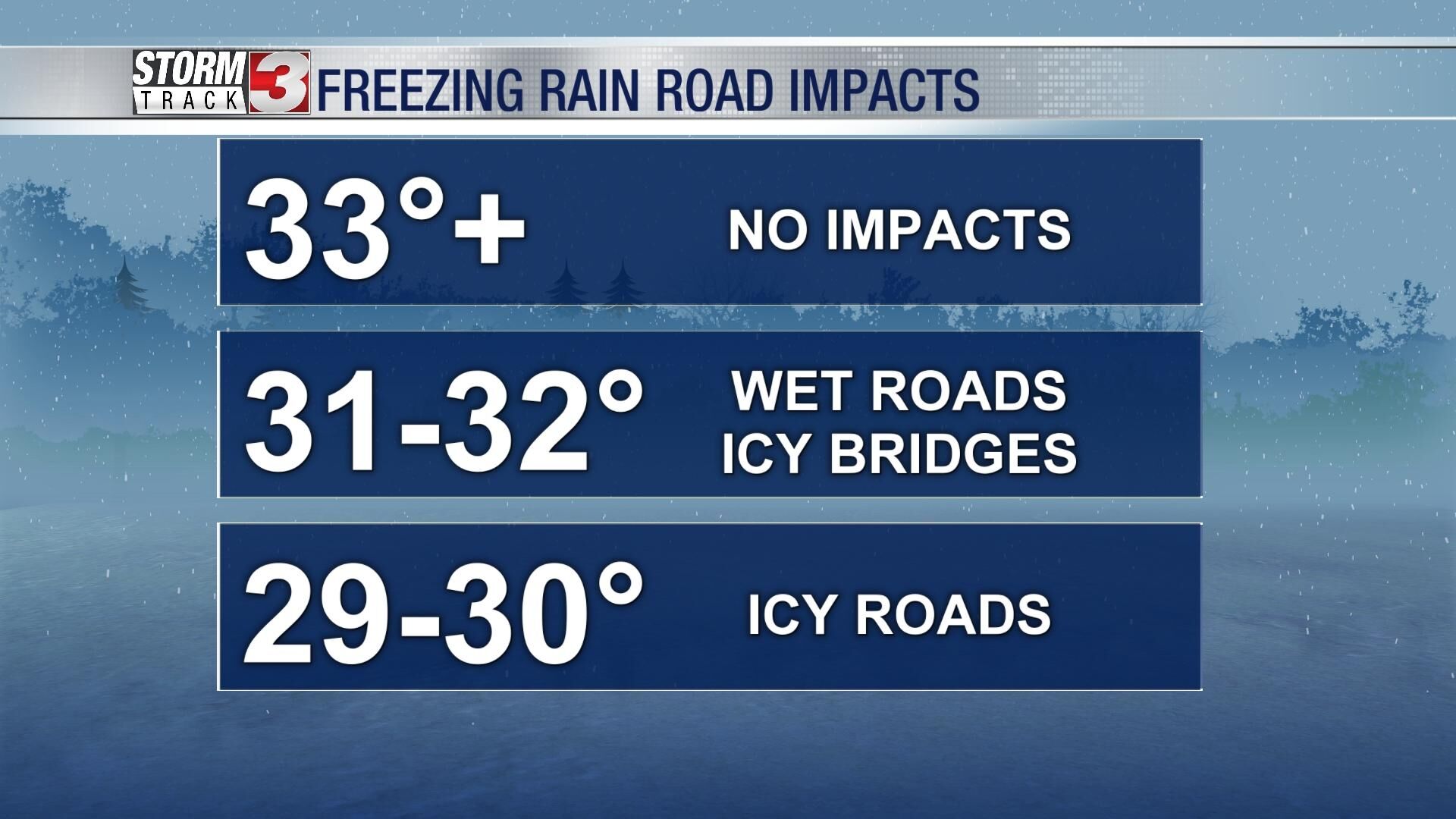
Farther east, temperatures have been running slightly warmer from Harrisburg to Paducah with readings 32-34º, so icing on roads is unlikely.
Light freezing rain and rain will continue to through mid-morning, but a break is then expected.
Another wave of winter weather is expected to arrive later this afternoon. Initially, sleet and snow may mix with freezing rain across parts of southern Illinois, but then it will turn back over to mostly freezing rain. The heaviest amounts will occur across the Missouri Bootheel, western Kentucky, and northwest Tennessee where 0.10" to 0.20" of ice is possible through tonight.
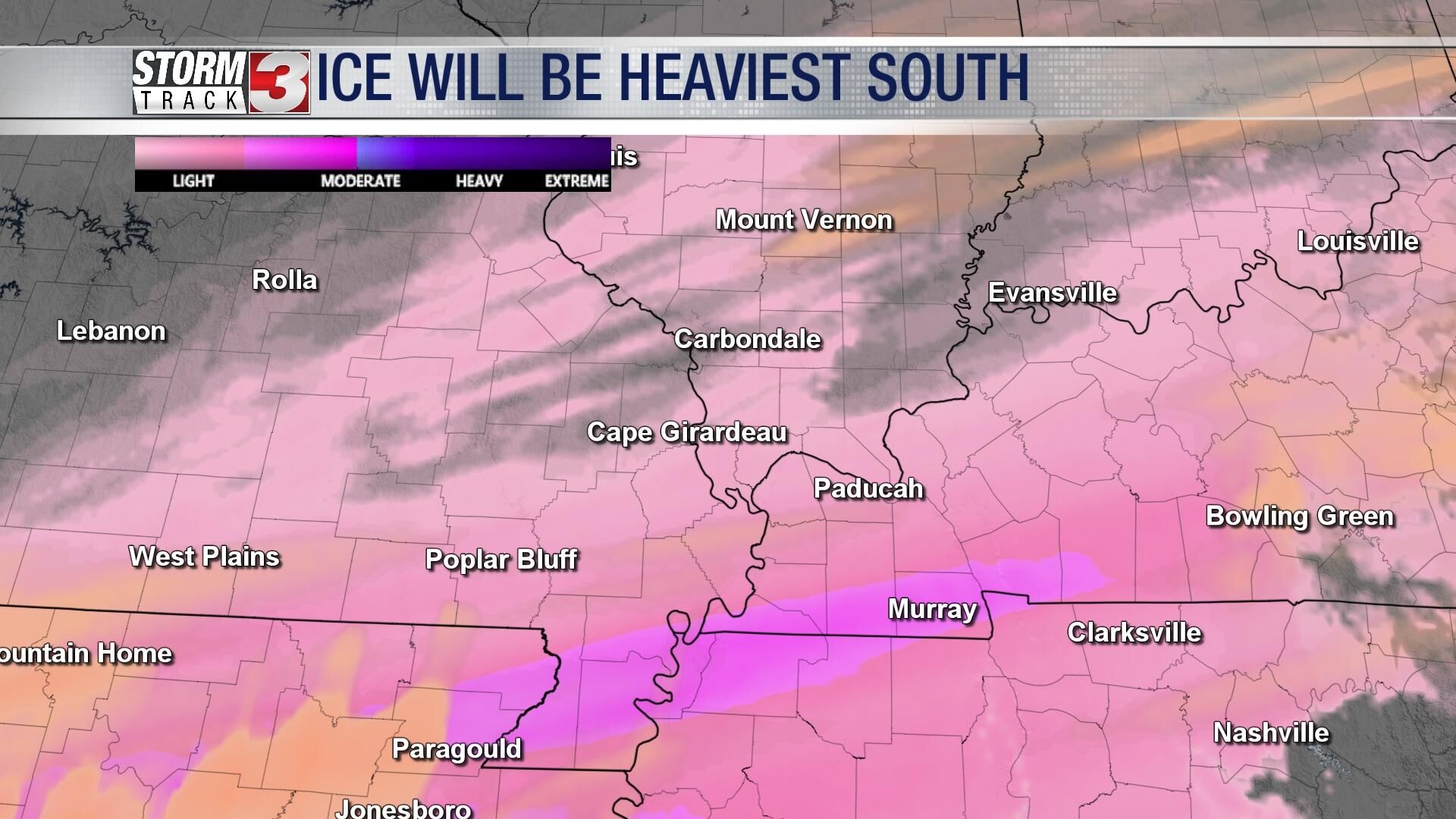
This is not enough ice to cause power outages, but small icing events can still cause major travel problems.
By daybreak Tuesday, freezing rain will be wrapping up in our region, but Tuesday will be a cold day.
Yet another wave of light freezing rain is expected Tuesday evening, mainly in the Bootheel and along the Kentucky/Tennessee state line.
Finally, temperatures will warm above freezing Wednesday, melting away ice quickly.