

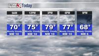

WSIL -- A light shower or two remains possible very early this morning, but as cool, less humid air begins to move in, rain will quickly exit to the east and southeast.

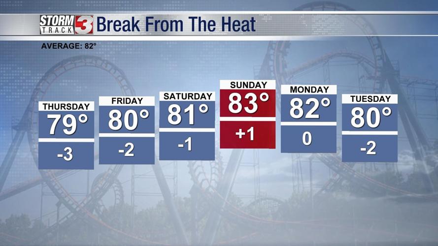
By this afternoon, mostly cloudy skies and the northwest breeze will keep temperatures into the upper 70s.

Friday and Saturday will be gorgeous days for June. The mornings will be in the 50s and the afternoons in the lower 80s with tolerable humidity levels.
Humidity begins to build back in Sunday, leading to a chance for a few hit & miss storms by the afternoon.

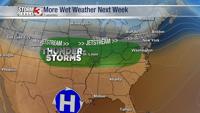
As the jetstream flattens out, a fast, active pattern sets up early next week. This will likely bring multiple waves of showers and storms into our forecast.