


WSIL -- Monday will be the "Pick of the Week" with above average temperatures a little bit of sunshine. Afternoon temperatures will peak in the upper 40s and winds will generally be light from the southeast.

Temperatures continue to climb into Tuesday with highs in the upper 50s, but rain will begin to arrive by late Tuesday afternoon.
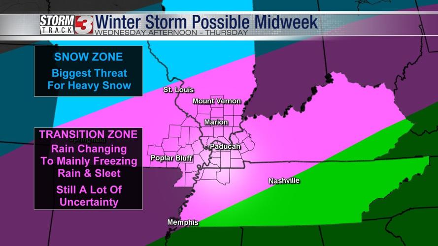
A potential winter storm takes aim at our region Wednesday and Thursday. Right now, it appears most likely that rain will begin to change to freezing rain Wednesday afternoon and evening across southeast Missouri and southern Illinois.

The biggest push of moisture is expected Thursday. There is still a lot of uncertainty on the amounts and locations of winter weather, but ice is the most likely type of winter precipitation.

A Winter Storm Watch has been issued by the National Weather Service for parts of southeast Missouri and southern Illinois beginning Wednesday evening and running into late Thursday night.