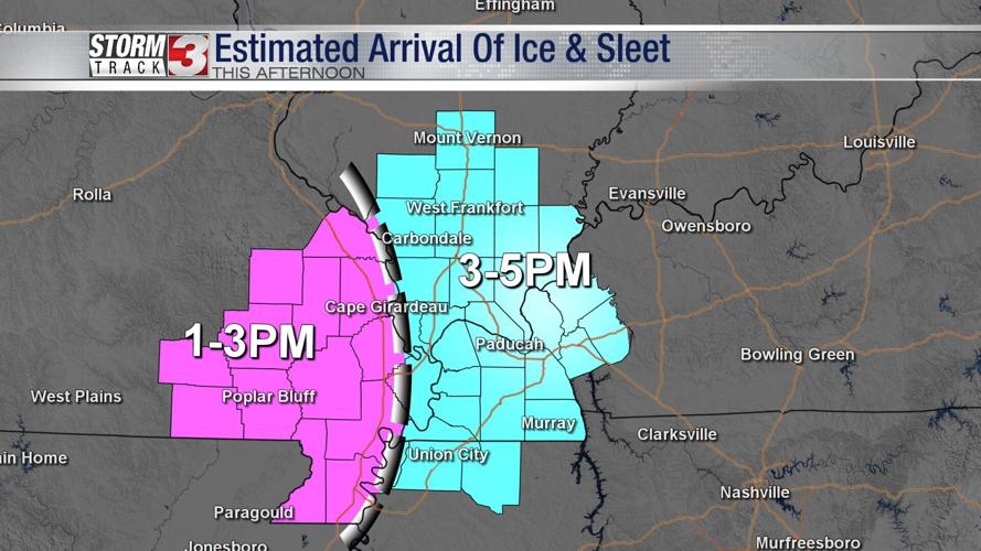


WSIL -- The next chance for winter weather is expected to arrival this afternoon. Precipitation type is likely to be freezing rain and sleet.

By mid-afternoon, sleet and freezing rain will begin moving into southeast Missouri and then continue eastward into southern Illinois and western Kentucky just before sunset.

This evening, most of the precipitation will be very light and impacts to roads will likely be confined to bridges and overpasses along with some secondary and rural roads.
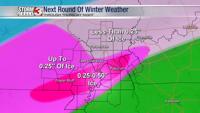
A second, heavier push of precipitation will spread into the region Thursday afternoon. Right now, temperatures are expected to warm above freezing across much of the region, thus changing much of this second wave over to rain. The one exception could be from around Perryville, Missouri to Mt. Vernon where freezing rain and sleet may continue to fall.

Amounts of ice will range from around 0.25" across southeast Missouri and a narrow corridor near the Ohio River. Meanwhile, amounts will be under 0.25" across southern Illinois. Any sleet that falls will be under 0.5".
Winter weather wraps up Thursday night, ending as a few snow flurries.