


WSIL -- Watch for patchy fog this morning, it could be quite thick in low-lying areas and could take a few hours to mix out after sunrise.
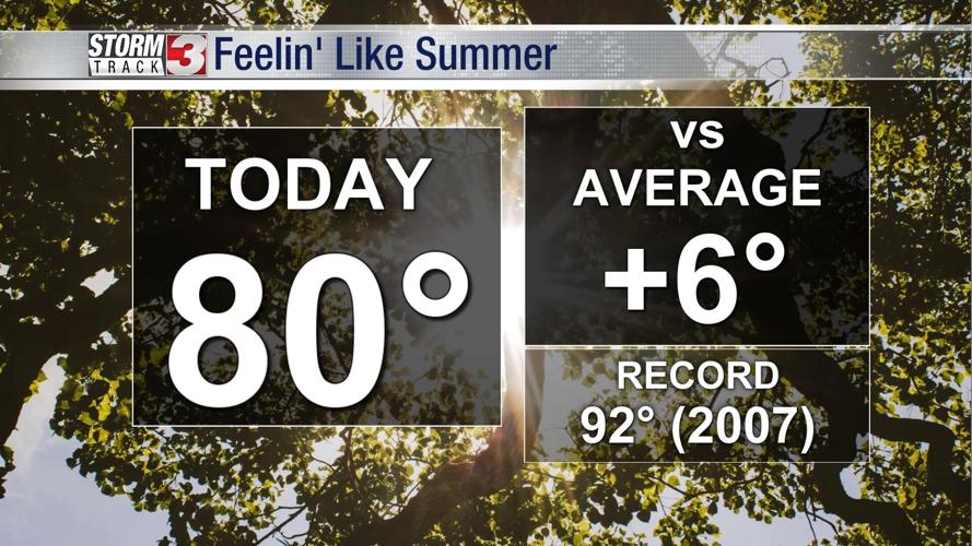
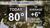
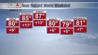
By this afternoon, sunshine will return and temperatures will start to ramp up. Friday highs will be around 80潞.
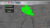
A fast moving disturbance could bring a couple of showers very late tonight into early Saturday morning across southern Illinois, but amounts will be light and rain will not stick around long.

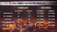
Near record warm temperatures are expected Saturday and Sunday afternoon with highs in the mid to upper 80s.

A potent storm system will bring storms on Monday and a slight cool down.


