


WSIL -- Warm & muggy this morning, temperatures overnight only falling into the lower 70s.
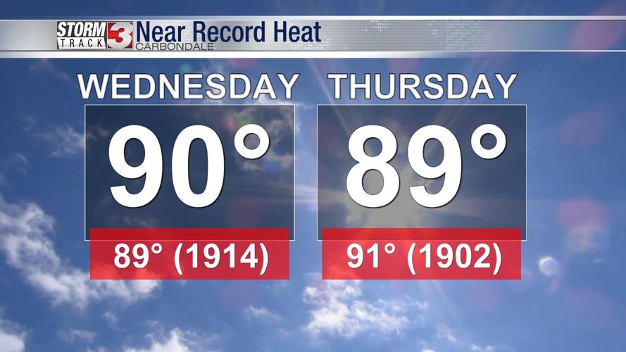
Another hot and humid afternoon, possibly the hottest of the week. Temperatures will peak 89-91º Wednesday afternoon and with the humidity factored in, the heat index will run 94-98º.

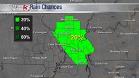
A spot shower or t-storm can't entirely be ruled out during the day, mainly east of the Mississippi River. Chances for rain remain low, but don't be surprised if there's one or two pop up showers Wednesday.

Slightly drier air will move in from the east on Thursday, likely bringing the humidity down a bit Thursday afternoon. Despite that, it's still going to be hot with afternoon temperatures in the upper 80s.
The weekend brings some relief from the heat as morning temperatures drop back into the lower 60s and afternoons in the lower 80s. A few scattered showers and storms are possible Saturday and a few more are expected Sunday as a cold front approaches from the northwest.