


WSIL -- If you need to get things done to winterize your home in preparation of bitterly cold air and potentially a little snow.
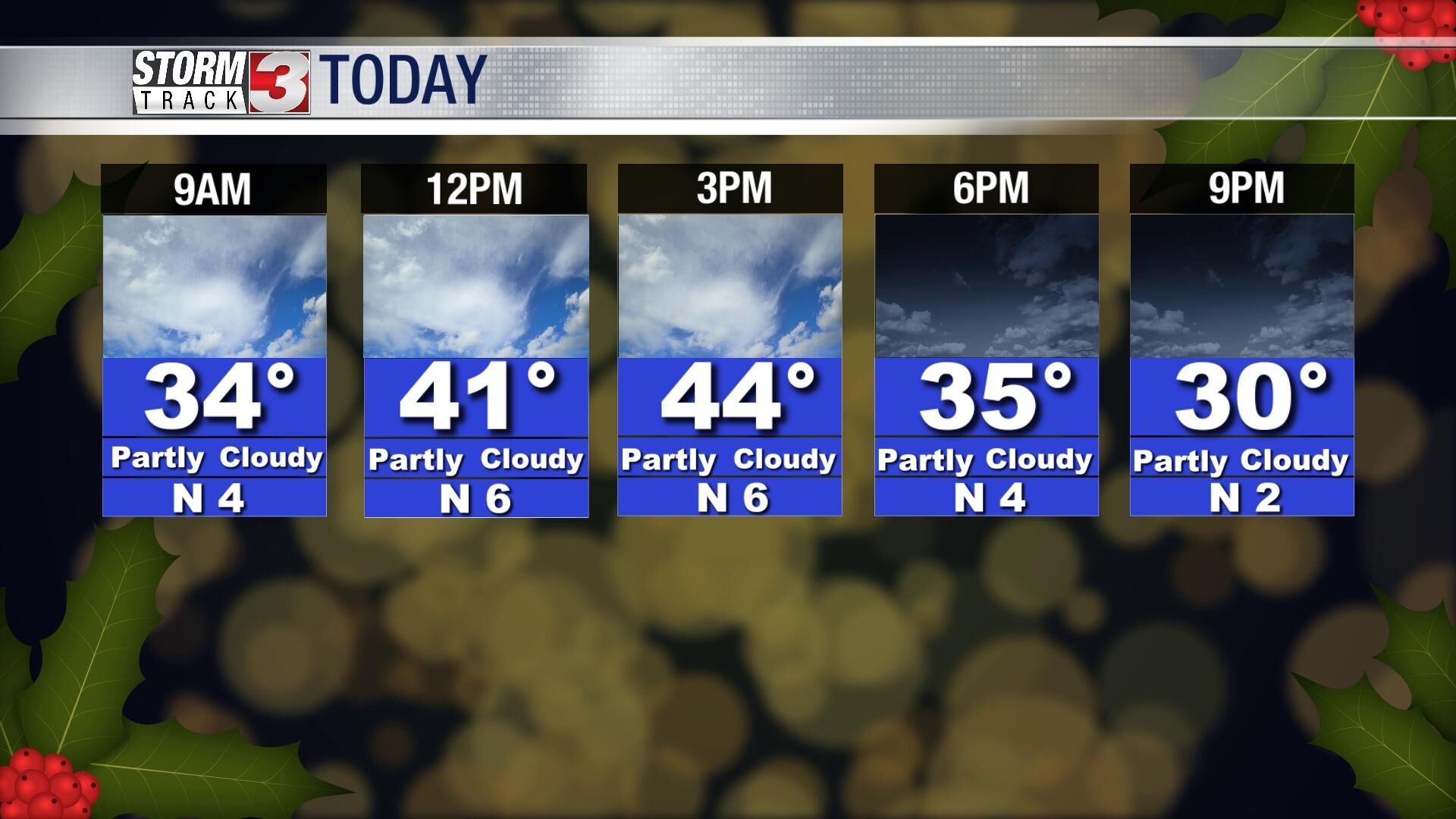
A little sunshine is expected Tuesday afternoon as temperatures climb into the mid 40s. Wednesday afternoon will bring more clouds, but temperatures will remain in the lower 40s.
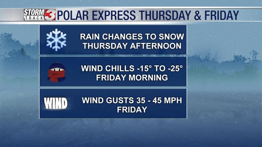
Thursday, a storm system will track from the Plains into the Midwest. Ahead of the cold front, light rain is expected across most of the region during the morning and into the early afternoon. Temperatures will be in the low to mid 40s ahead of the front.
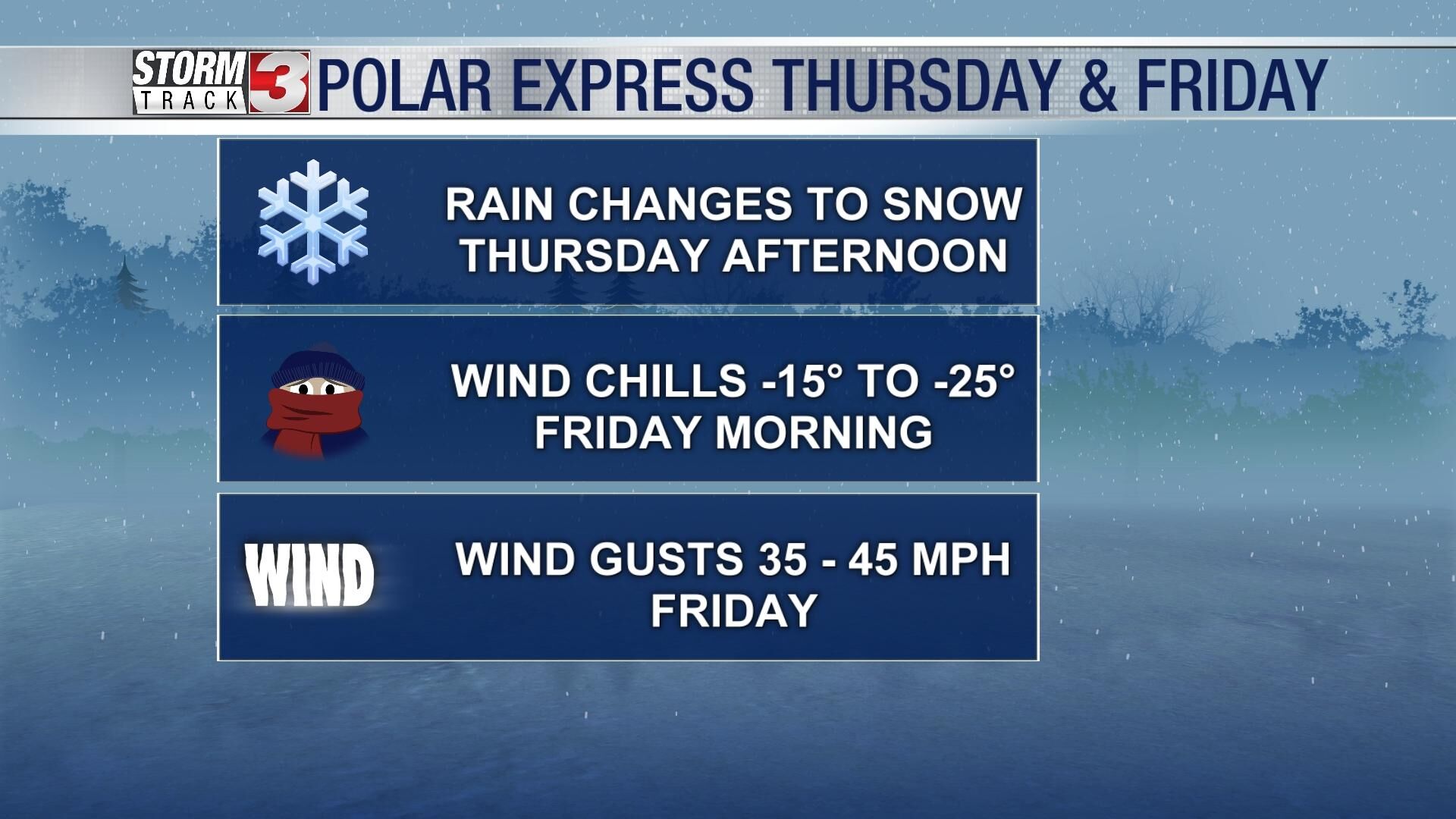
By mid to late afternoon, a potent Arctic cold front will sweep across the region. This will quickly change rain over to snow and send temperatures plummeting. Winds will strengthen behind the cold front from the northwest gusting over 30 miles per hour. Blowing snow will likely reduce visibility and make travel very difficult Thursday evening. Snow will end quickly Friday morning.
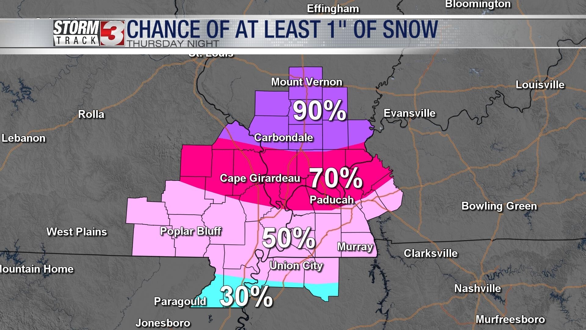
The exact amounts of snow are still somewhat uncertain, but it will not take much snow to cause big problems on roadways with a potential flash freeze adding to the icing.

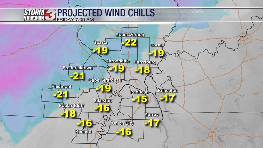
By Friday morning, temperatures are now expected to drop below zero, especially in southern Illinois. Dangerous wind chills are expected with reading -15 to -25º possible. Wind chills will remain below zero during the day Friday and at least through Saturday morning.
Temperatures will remain well below freezing through the weekend with Saturday and Sunday mornings in the single digits and afternoons only in the teens and lower 20s.
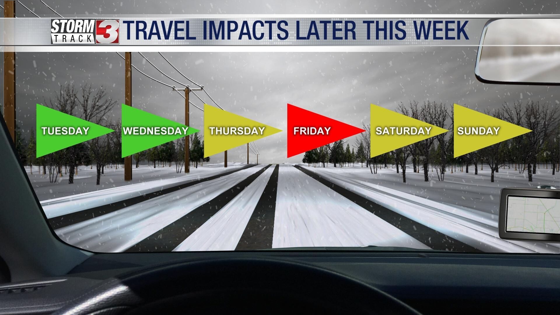
Travel is not advised locally from late Thursday afternoon through Friday. The weekend is likely to still have some travel impacts, especially for people heading north where even more snow is expected.