


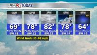

WSIL -- Very warm this morning with temperatures in the mid to upper 60s.

Today is the last afternoon for at least the next 10 days with highs in the 80s.
Strong winds from the south and west could gust over 35 miles per hour today.

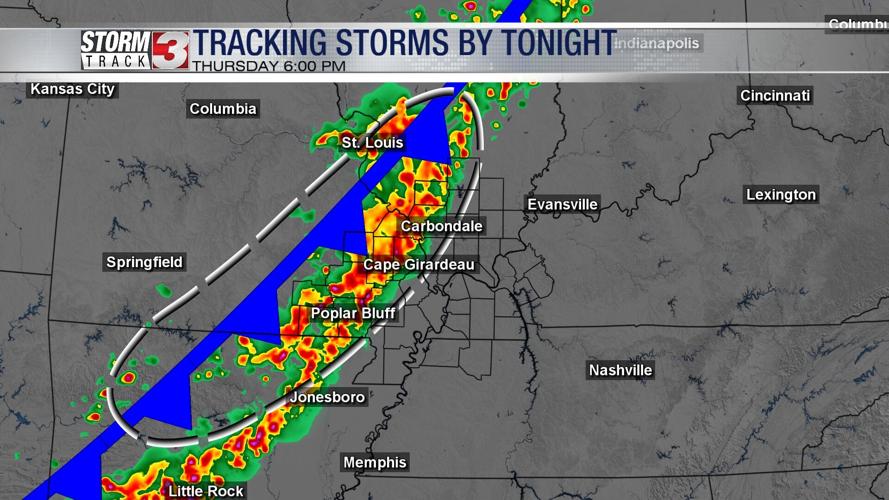
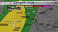
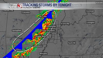
A line of storms is expected to develop along and ahead of the cold front later this afternoon stretching from St. Louis south to the Ozarks of Missouri. These storms will track into southeast Missouri and southwest Illinois between 4 and 6 p.m. Initially, some of these storms could be strong with hail and isolated damaging winds.
Storms will lose intensity quickly after sunset, but as the cold front stalls over the area, heavy rain is likely to set up over southeast Missouri and southern Illinois.
Rain will gradually shift southeast towards Kentucky early Friday morning.
For southern Illinois, there will likely be a break in the rain from mid morning to the early afternoon. As a secondary storm system develops south, light rain is likely to move back to the north, leading to more wet weather across at least southeast Illinois.
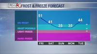
Finally by Saturday morning, rain will end, but much colder air will arrive for the weekend. High temperatures this weekend will only be in the mid to upper 50s.

Sunday and Monday mornings will see temperatures dip into the mid 30s, especially in southern Illinois. Patchy frost is likely to develop, especially as winds relax.