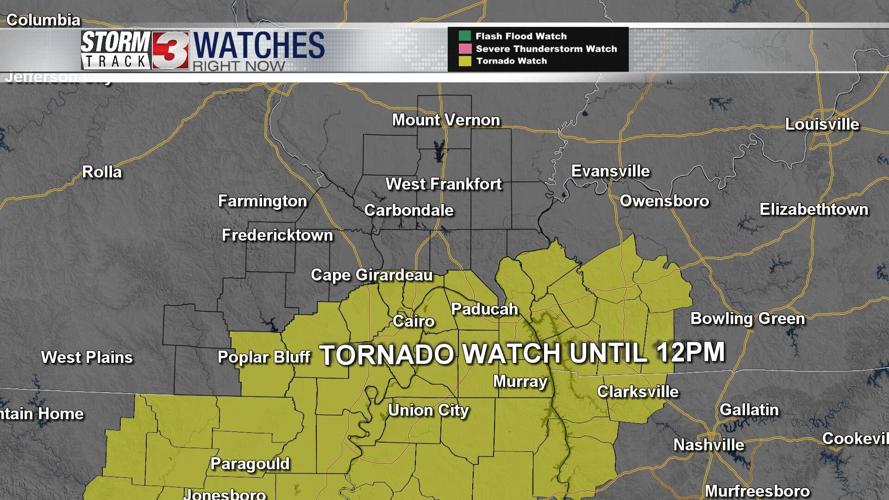


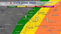

WSIL -- A Tornado Watch is in effect for parts of far southern Illinois, southeast Missouri, and western Kentucky until 12 p.m.

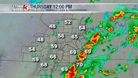
A warm front is currently draped along Highway 60 in southeast Missouri and running near the Ohio River between Illinois and Kentucky. Along and south of this boundary is where there could be a few more strong storms this morning.
The main threats will be localized flash flooding, isolated strong wind gusts, and hail. A brief tornado or two can't entirely be ruled out.

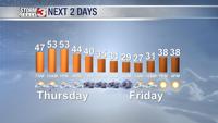
By this afternoon, the storms quickly track east of the region as a cold front sweeps through. In the wake of the front, temperatures will fall back into the upper 30s by tonight.

Friday will be a winter-like day. Morning temperatures will be in the upper 20s, but despite sunshine, afternoon highs will only be in the upper 30s.
Temperatures bounce back quick this weekend with upper 40s Saturday and mid 50s on Sunday.