


CARTERVILLE, Ill. (WSIL) -- Fairly pleasant afternoon with only a few stray showers popping up. However, we are tracking the chance for strong to severe storms later this afternoon and evening.
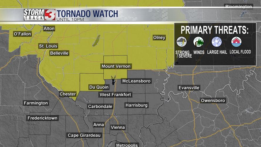
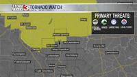
A TORNADO WATCH has been put into effect for Perry and Jefferson county in southern Illinois until 10PM.
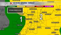
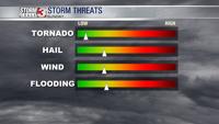
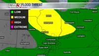
The SPC currently has us under a Level 2 out of 5 for the risk of damaging winds and large hail.

There is a few areas of uncertainty, but before I list those I will list what we do know.
WHAT WE KNOW:

A warm front has lifted over the region with a cold front still off back into Missouri. As that cold front moves eastward it will bring the chance of showers and storms, some of which could be on the stronger side. At this point in time, it looks like the northern portions of southern Illinois could see storms become strong to severe by later this evening. The main risks being damaging winds and large hail.
The uncertainty:
As the cold front pushes eastward it's a question of how much of the energy will align. Currently, the winds do not support storm initiation for a majority of the region. Models show storms stay further north into Jefferson and Franklin counties, whereas other model inputs show a few storms even further south of that. With the SPC outlook being so widespread, it further shows the uncertainty coverage of where sees what.

At time point, it would appear the best storm chances remain into a very small sliver of southeastern Missouri sliding into southern Illinois. DO not get caught off guard if development shifts to other regions. You should always be prepared in case severe weather comes to your area.
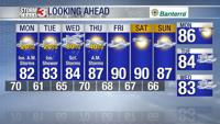
Monday: Morning lows will be into the lower 70's with afternoon highs into the lower 80's. A few stray showers will be possible. Partly cloudy with winds from the W 10-15mph gusting up to 20mph at times. A much cooler day ahead.

Tuesday: Morning lows into the mid and upper 60's with afternoon highs into the mid 80's. Partly cloudy. Winds from the NW 5-10mph. An isolated shower will be possible.
Going into Wednesday and Thursday more chances of heavy rain and storms return. That is far away from this date and you should download the Storm Track 3 App to get the latest updates.