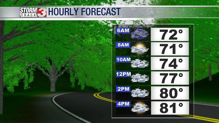


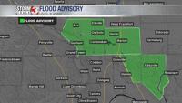

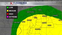


CARTERVILLE, Ill. (WSIL) -- Heavy morning showers and a cooler end to the weekend.


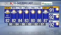
Sunday: Morning lows into the lower and mid 70's. Afternoon highs going into the upper 70's and lower 80's. A few showers will continue to move through the region as yesterdays system exits. Winds from the NNW shifting NW 5-10mph, a few gusts up to 15mph possible through the afternoon. Mostly cloudy becoming partly cloudy and clearing late afternoon and evening.
Monday: Morning lows into the lower to mid 60's with afternoon highs into the lower to mid 80's. Some early morning isolated showers will be possible into southeast Missouri. Partly cloudy. NE winds 5-10 mph with gusts up to 15mph possible.
Tuesday: Morning lows into the lower to mid 60's with afternoon highs into the lower to mid 80's. Sunny to partly cloudy. N wind 5-10mph.
Going into the midweek, staying dry and cool. Mix of sun and clouds remain. By the weekend it appears the heat will try to come back into the region.

Of course, a lot can change when it comes to long-range forecasting.
Stay ahead of your plans and the rain! Download the Storm Track 3 App. It's FREE on Google Play and the Apple App Store.