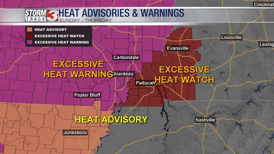


CARTERVILLE, Ill. (WSIL) -- Most of the region is under heat related advisories, watches and warnings.
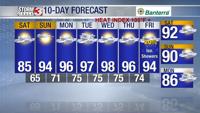
Saturday: Areas of patchy fog. Morning lows into the upper 50's and lower 60's. Afternoon highs forecast to reach the mid and upper 80's. Mostly sunny. A few passing clouds. S winds 5-10 mph.

Sunday: EXCESSIVE HEAT WATCH. EXCESSIVE HEAT WARNING. HEAT ADVISORY: All in effect for our region beginning Sunday at noon. The NWS Paducah has extended the warning until next Thursday. This is going to be the seasons longest heat warning for our region. This could pose stress and strain on people, pets and even power grids. Make sure to prepare for any type of heat-related illness by taking all precautions when outdoors.

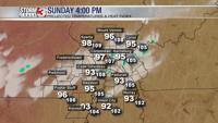
Morning lows will be into the mid and upper 60's with afternoon highs forecast to reach into the lower to mid 90's. The heat index will make temperatures feel like the lower 100's as dew points climb into the lower to mid 70's. SW wind 5-10mph. Mostly sunny.

Monday: EXCESSIVE HEAT WARNING. Morning lows into the lower to mid 70's with afternoon highs forecast to reach the mid and upper 90's. Heat index values could reach above 105. A mix of sun and clouds. S wind 5-10mph.

Looking ahead the heat looks to linger as high pressure continues to stay in place over the region beyond the midweek next week.
Download the Storm Track 3 App on Google Play and the Apple App store to receive all your weather alerts.