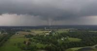
PADUCAH, Ky. -- The National Weather Service has confirmed an additional two tornadoes struck the region on Sunday, May 26.Â
The two additional tornadoes bring the current total to 14. The NWS previously confirmed 12 of the twisters on Thursday.Â
PADUCAH, Ky. -- A total of twelve tornadoes touched down on Sunday, May 26, as two storm sys…
The two tornadoes confirmed on Saturday occurred in Buncombe in Johnson County and Calloway County.
The NWS in Paducah has spent the week since the storms surveying the areas hit by the storms. The teams use the damage to determine the estimated strength and path of the storms.Â
Details on these storms are described below, per the NWS Paducah:
Tornado #13 - Buncombe, Illinois (Johnson County)
- Date -- May 26, 2024
- Time -- 8:14 - 8:22 p.m.Â
- EF Rating -- EF-1
- Est. Peak Winds -- 100 mph
- Path Length -- 7.05 miles
- Max Width -- 100 yards
- Injuries/Deaths -- 0/0
- Summary -- The tornado began just east of Interstate 57 in Union County, and crossed into Johnson County ending just east of Buncombe. Much of the path was marked by tree damage with numerous trees snapped or uprooted. A few outbuildings and a barn were heavily damaged about two and a half miles northeast of Elvira, near South Lick Creek Road. Additional tree damage was found near Buncombe where several trees were uprooted and snapped. A carport was flipped over onto its side in Buncombe.
Tornado #14 - Calloway County, Kentucky
- Date -- May 26, 2024
- Time -- 8:25 - 8:46 a.m.Â
- EF Rating -- EF-1
- Est. Peak Winds -- 105 mph
- Path Length -- 22.86 miles
- Max Width -- 100 yards
- Injuries/Deaths -- 0/0
- Summary -- The tornado appears to have begun just west of Lynn Grove near the Graves/Calloway County line. Concentrated tree damage was evident in Lynn Grove. Several buildings sustained minor roof damage from wind and significant damage from falling trees.Â
A very narrow path then continued southeastward between Wiswell Road and Highway 94 into far southern Murray. Damage was more sporadic and minor but grew more intense in south Murray with a few healthy tree trunks snapped. Damage then continued more sporadically just south of Highway 121.
Several wheat fields showed complicated swirl and straight-line wind damage patterns along this path. Damage became more intense once again southwest of New Concord before moving across Highway 121 and into the Cypress Springs community where several roads were impassable due to fallen trees. The damage then became inaccessible but may have continued to Kentucky Lane.Â


