


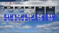


WSIL -- A Freezing Fog Advisory has been issued for parts of southeast Missouri until 9 a.m. this morning. Freezing fog can lead to black ice developing, especially on bridges and overpasses.

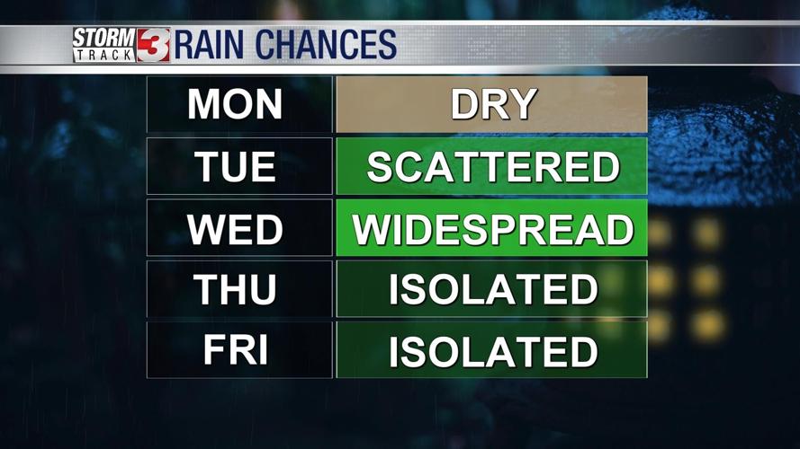
Cold outside this morning, but a little sun and south winds will cause temperatures to climb quickly. Monday will be the pick day of the week with high temperatures in the upper 50s.

A cold front tracks into the region on Tuesday, this will bring an increase in a few scattered light showers, especially during the midday hours.
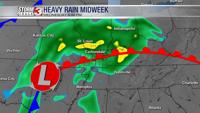
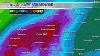
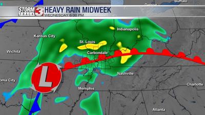
This cold front will settle into western Kentucky by Wednesday morning, but as low pressure moves out of the Red River Valley, the boundary will then lift back north as a warm front. This will set the stage for a lot of wet weather.
Rain will be widespread Wednesday, but will be heaviest during the afternoon and evening. Right now, it appears thunder and lightning will be possible, but severe storms will stay south of our region.

Heavy rain will be the biggest concern with widespread 1.5-3.0" expected through Thursday morning. Flooding is possible, especially in low-lying areas.

A few showers may linger around into early Thursday morning, but most of Thursday will be dry.
A secondary system will bring a few more showers Friday, and it may be cold enough to mix in with a few snowflakes.