


WSIL -- A weak upper-level disturbance has led to the development of a few storms along the Mississippi River between southeast Missouri and southern Illinois. These storms will likely fade away pretty quickly after sunrise this morning, with areas along and east of I-57 remaining dry.

For most of the region, Wednesday will be a pleasant day with an east wind keeping humidity levels down and temperatures around 80º.

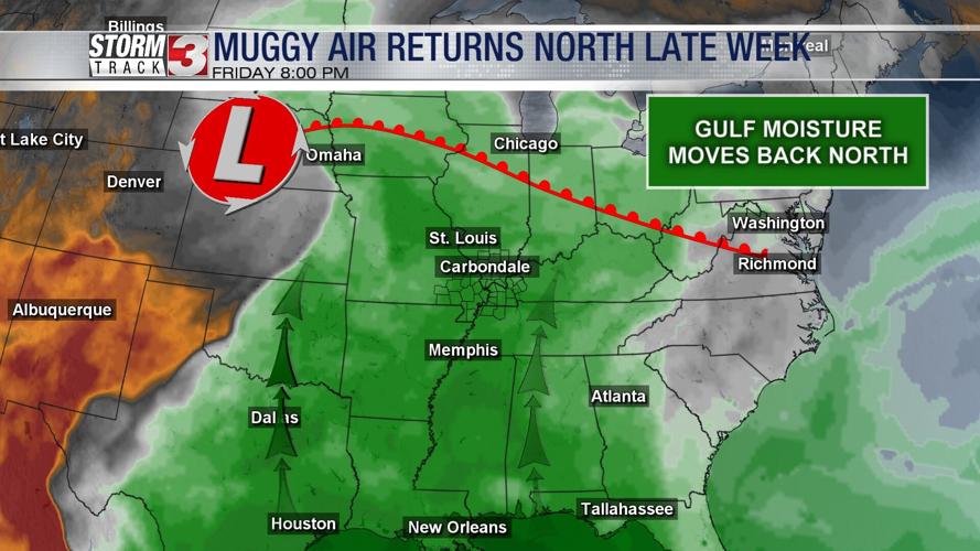
The pattern begins to change tonight with showers and storms becoming likely in the Missouri Bootheel and northwest Tennessee as a boundary brings a big increase in humidity back north.

The mugginess will return with dew points in the upper 60s and lower 70s starting Thursday and continuing through the weekend.
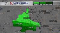
Scattered showers and storms will also return and continue through the weekend. All day rain looks unlikely, but occasional heavy downpours and lightning will be possible.
A cold front will arrive Monday, shifting the humid air south and taking the rain chances south next week.