


WSIL -- Another rounds of storms overnight, but this time, they hit areas where the rain was needed, primarily parts of southeast Missouri.

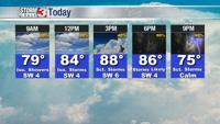
Outside a stray shower or storm, most of the day will be dry, but temperatures will once again climb into the upper 80s and the humidity will be running high.

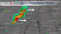
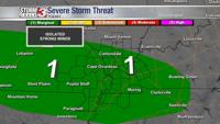
Our attention will turn to a complex of storms expected to develop across the Missouri Ozarks late this afternoon. These storms will track eastward across southeast Missouri, southern Illinois, and western Kentucky through the early evening. Very heavy rain, lightning, and isolated strong winds are possible.

By Friday morning, storms will sag south to the Missouri Bootheel and northwest Tennessee. Farther north, cooler, slightly less humid air will begin to move in across southern Illinois.
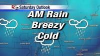
The stalled front will continue to provide a chance for showers and storms through the weekend and even into early next week.

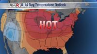
Rain chances finally exit the forecast by Tuesday, but temperatures quickly bounce back into the 90s.