

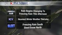


WSIL -- A major winter storm is anticipated over the next 48 hours with heavy amounts of freezing rain, sleet, and snow all possible.

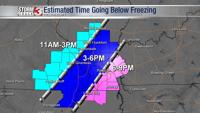
Rain is expected to continue this morning, but temperatures will gradually begin to fall below freezing across parts of northwestern Jackson County, Perry County, and Jefferson County in southern Illinois by midday.

This will result in a switch to freezing rain in these areas, liquid freezing on contact to elevated surfaces initially, and then possibly sidewalks and some roads by mid to late afternoon.
Precipitation will become lighter later this afternoon and evening as a lull is expected between wave one and wave two sets up. Despite being lighter, slick roads may still develop as it just does not take much for ice to become hazardous.
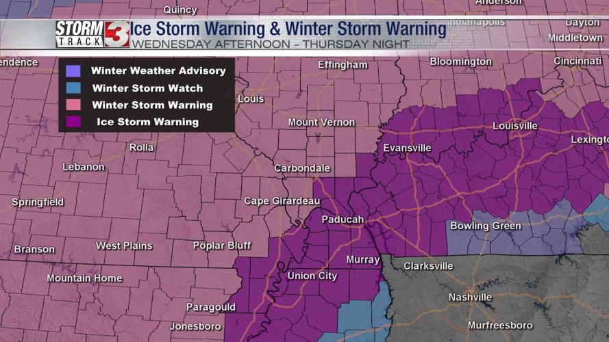
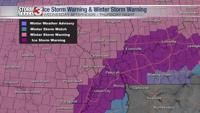
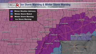
The main event arrives overnight into Thursday morning. Heavy freezing rain sets up across western Kentucky, northwest Tennessee, and the Missouri Bootheel. Meanwhile, more sleet is expected north of the Ohio River in southern Illinois and southeast Missouri.
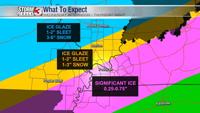
Throughout Thursday morning, a switch from sleet to snow is expected to occur from the northwest. 3-6" of snow may fall from Pinckneyville to Mt. Vernon on top of 1-2" sleet. Farther south, from Carbondale to Harrisburg 1-3" of snow may fall on top of 1-3" of sleet.

Plan for school closures Thursday and likely Friday along with major disruptions to everyday routines.