


WSIL -- A few isolated showers are possible this morning, but it's likely not worth getting too worked up about as they will be quick and very light.

By this afternoon, sunshine will return and temperatures will bounce into the upper 40s and lower 50s.
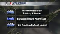
All eyes are on a potential winter storm taking shape this weekend. A big system is set to track from the Plains into the Deep South.
A rain and snow mix is likely to spread in from the northwest Friday night and gradually change over to snow, especially Saturday morning.

Right now, forecast models are hinting at the heaviest snow falling across southeast Missouri and western Kentucky, with slightly lesser amounts north into southern Illinois.

There is still a lot of uncertainty regarding the amounts and the placement of the heaviest snow. Patience is needed when forecasting winter weather.