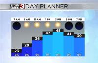


CARTERVILLE Ill. (WSIL) -- The last of the rain Thursday, is starting to move out of the region. Behind it, blue skies are peeking out with comfortable temperatures. Quiet conditions will stick overnight, enjoy the break.
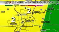
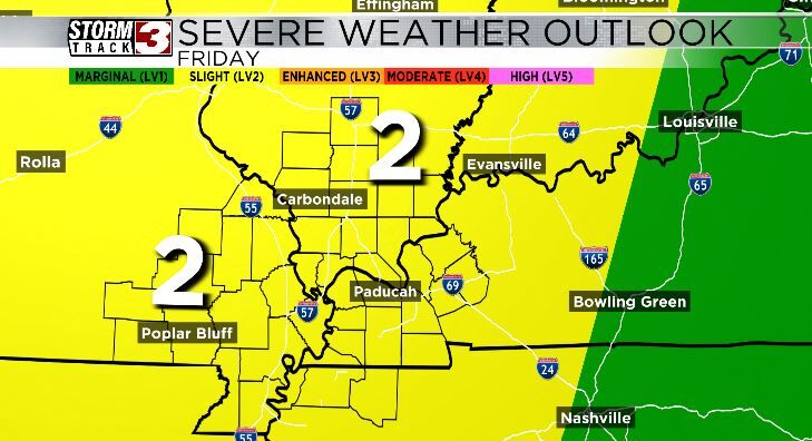
Spotty showers and storms will be possible through the southern half of the region, early Friday. However, many will stay dry until the afternoon and evening. There is some uncertainty regarding storm coverage Friday afternoon and evening, but storms are likely. A line of storms is expected to move in from the west during the afternoon and evening. Much of the area is under a slight risk (2 out of 5). The main hazards will be strong winds and hail.
Isolated storm chances linger into Saturday but most will stay dry. Both Saturday and Monday look to be the driest days.

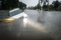
Sunday will be a day to monitor closely, especially if you have plans to camp or be outdoors. The ingredients projected currently support a widespread severe weather event. All hazards would be possible, including tornadoes. This is still several days away. Timing and finer details will continue to be worked out in the coming days. For now, have a plan, be ready to stay weather aware and keep up with the latest forecasts.