


WSIL (Carterville) -- As you're headed out this morning, you'll definitely feel the humidity. Winds are steady out of the south which is keeping temperatures and dew points high.
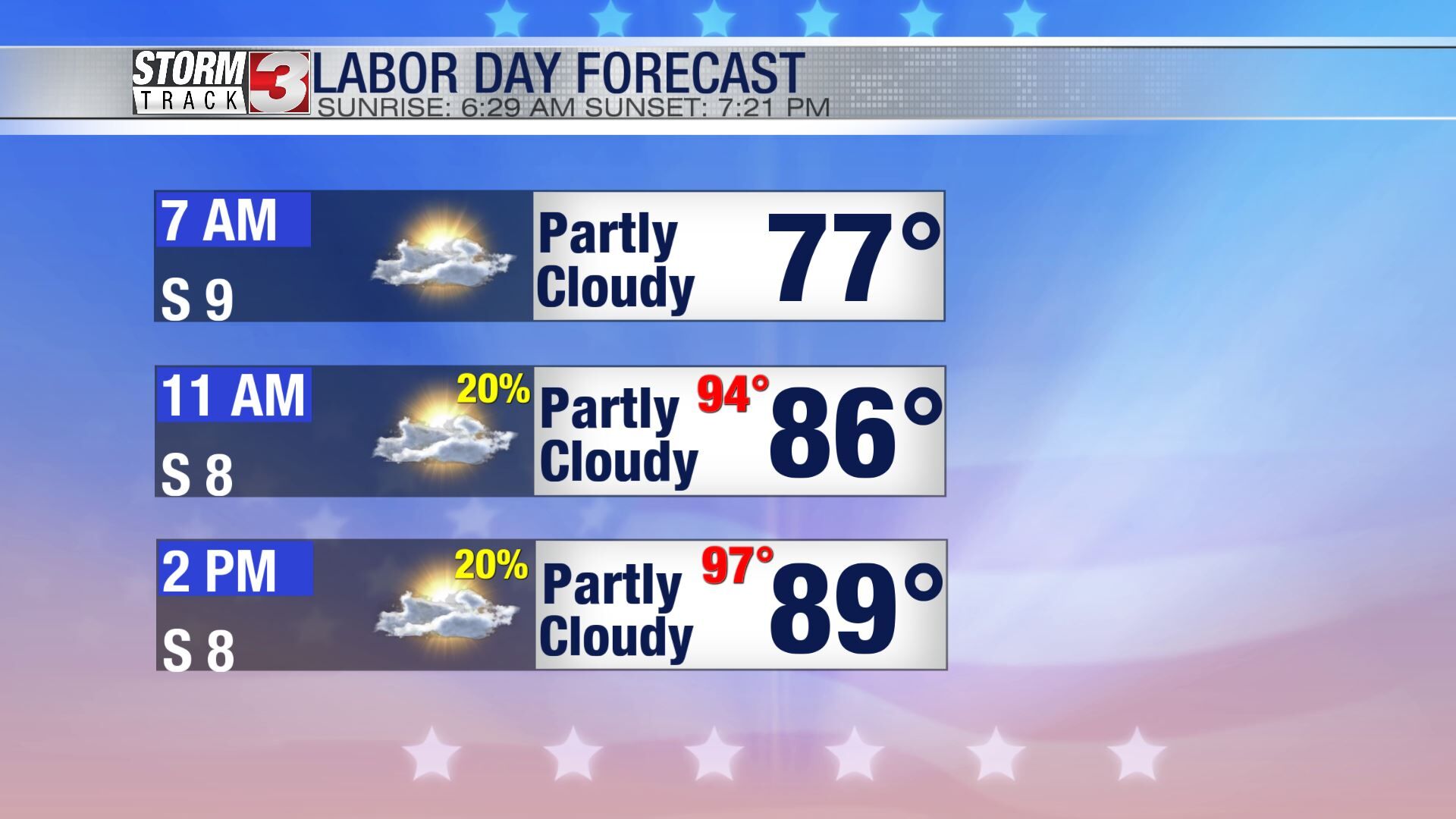
Temperatures quickly heat up with highs today in the upper 80s, low 90s. It'll feel much hotter with heat indices in the mid to upper 90s. There's a few chances for some isolated showers but it's not worth cancelling any of your outdoor plans! Just keep an eye on radar and updates.
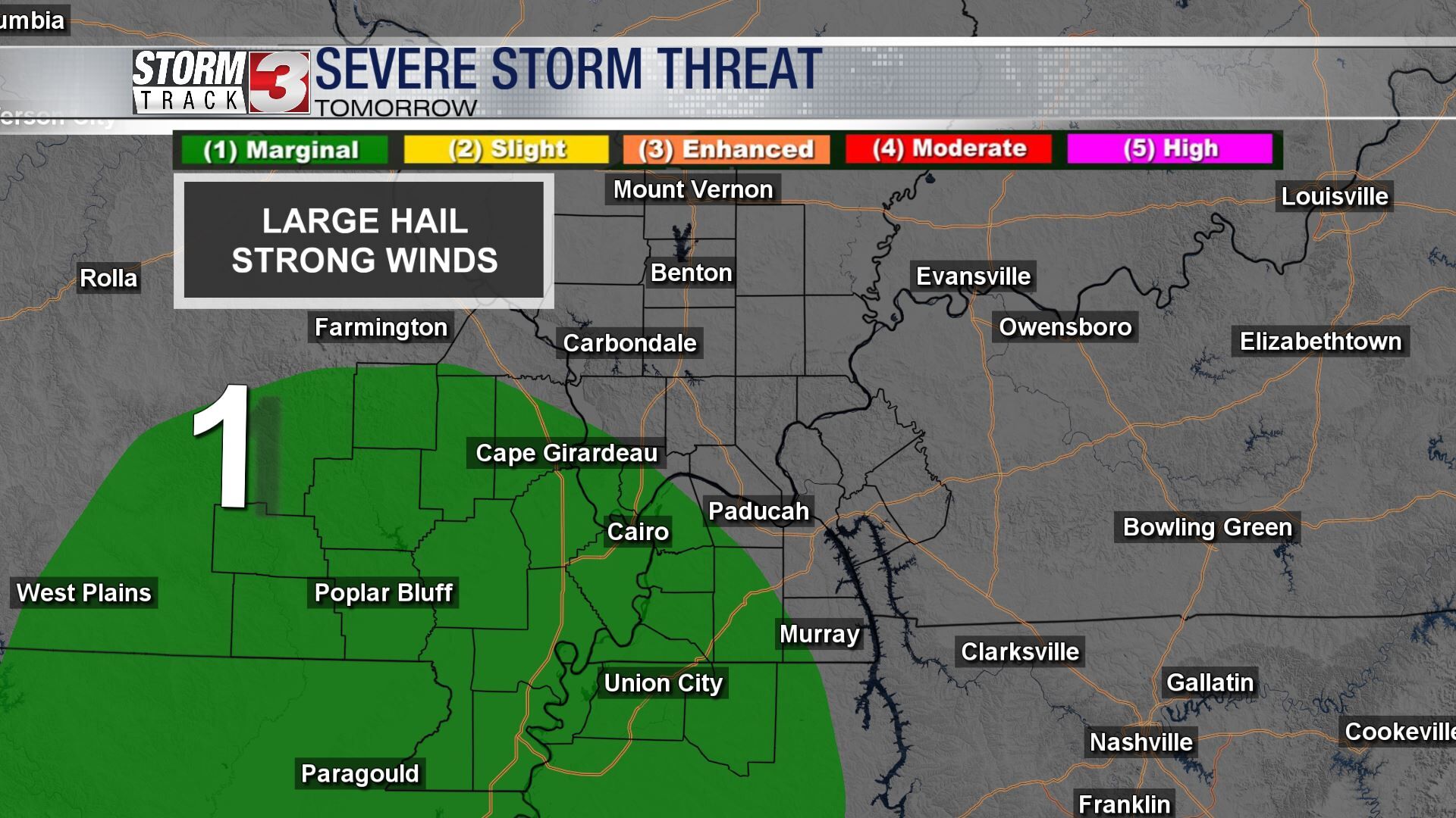
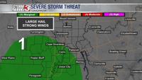
If you plan to make your long weekend a bit longer and have more outdoor plans tomorrow, then you may need to cancel. The Storm Prediction Center has our Western and Southern counties in a Marginal (1 out of 5) risk. Highest threats continue to be large hail and damaging winds.
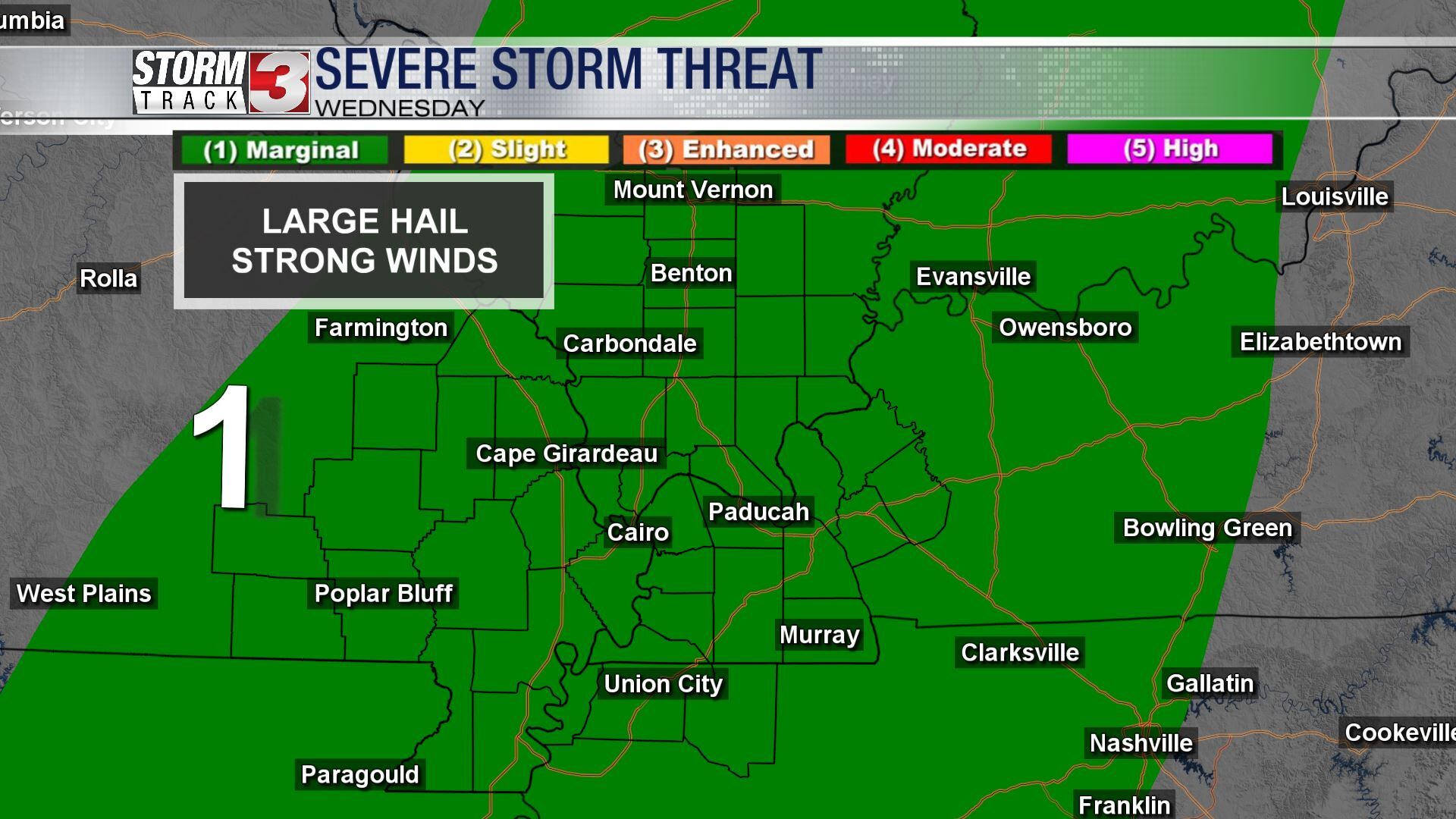
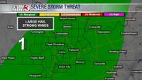
Severe threat lingers into Wednesday as well but the big difference is everyone is highlighted in the threat. It's all thanks to a sweeping cold front.
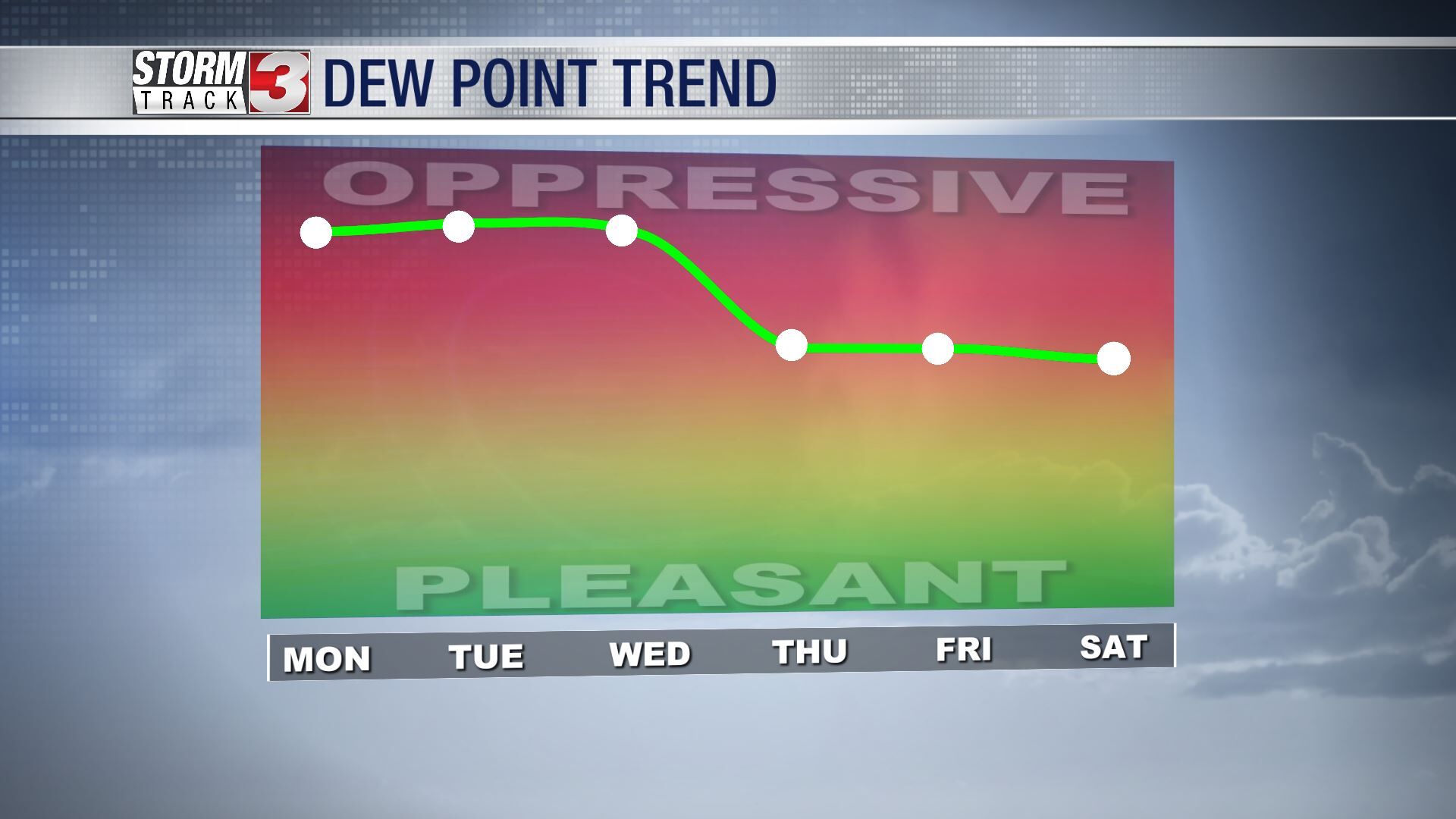
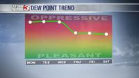
Behind the front, much cooler air will move in. High temperatures won't be a big swing but humidity will really dip. Conditions will feel more fall-like in the second half of the week.