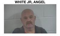

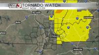


WSIL(Carterville, Ill.) -- This evening, we are tracking a Tornado Watch that is in place for ur far eastern counties in southern Illinois, including Jefferson, Hamilton, Saline, Galliatian, Pope, and Hardin counties and the cities of McLeansboro, Harrisburg, and Mt. Vernon . This watch is in place until 11 PM this evening for the potential for one or two strong to severe storms along and east of I-57. Outside of the tornado watch, we are also tracking a Wind Advisory until 7 PM this evening, for wind gusts that could be as high as 50 miles per hour. There is also a Red Flag Warning in place until 10 PM for elevated fire weather conditions. So outdoor burning is not recommended.
For the evening, the best window for storms will be between now and 8 PM. These storms are associated with our next cold front. This will push through between 6 and 10 PM. Once the front passes temperatures will drop significantly. By 7 PM, temperatures will be in the upper 50s for most of us and into the upper 40s by midnight.

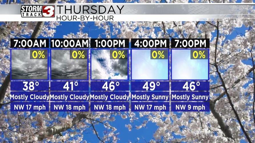
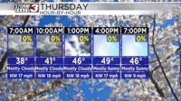
For the first day of spring temperatures will be on the cold side, with morning lows expected to be in the upper 30s, with highs in the lower 50s. Winds tomorrow will also be on the breezy side, with northwesterly winds at 20 to 25 miles per hour. Skies tomorrow morning will be mostly cloudy, but then mostly sunny skies are expected for the afternoon.
For Friday and the weekend, we will see temperatures return to the lower 60s, uncer mostly sunny skies. We will see a chance for showers and thunderstorms Sunday, but nothing severe is expected.