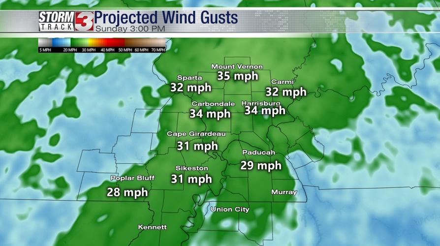


WSIL (Carterville) -- It's a sunny and warm end to the weekend with highs today reaching the upper 50s. The winds have begun to pick up, with some areas experiencing gusts close to 35 mph.聽
Into tonight, skies will remain clear with temperatures falling into the low 40s.聽
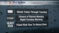
Clouds will return Monday morning, along with warmer temperatures. There's a good chance a lot of us will reach 60 degrees. There are two systems to keep an eye on this week. The first begins Monday afternoon into the evening as our chance for showers increase.聽

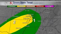
The Storm Prediction Center currently has our area under a marginal (1) and slight (2) threat due to the risk of storms, flooding and windy conditions on Monday into Tuesday.聽
A cold front will sweep through Tuesday around noon, bringing severe weather and leaving behind cold temperatures. Tuesday morning into afternoon looks to be the most active in regards to heavy rainfall and thunderstorms.聽

Rivers are at high risk of flooding due to the large amount of rain we received last Thursday, on top of what we expect to see this week.聽
Looking ahead to the later half of the week, the second system is expected to begin Wednesday afternoon/evening and it has the potential to bring winter weather thanks to the drop in temperatures caused by the cold front. The Storm Track 3 team will continue to update on what to expect later in the week.聽