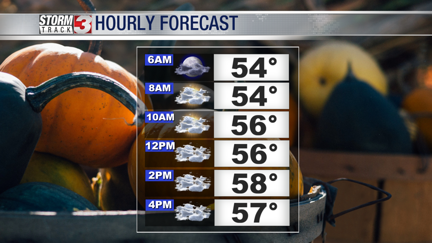


WSIL(Carterville, IL)-- Today, we are tracking well below temperatures for today. We have already hit our high temperature for today early this morning. As we go throughout the morning, most of us will start in the low to mid-50s, and will not get much warmer this afternoon. Temperatures this afternoon will likely be in the mid to upper 50s.

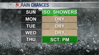
There will be overcast skies throughout most of today, as well as an isolated chance of showers, mainly in the afternoon and evening.

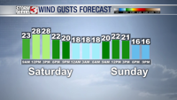
While we will not see much of an increase in temperatures today, we will see winds increasing throughout the day. Winds should be fairly calm early, but by 9:00 AM, we could see sustained winds of up to 10 miles per hour, and by mid-afternoon, we could see them increase to 15 miles per hour, with gusts peaking around the same time at 25 to 30 miles per hour. Winds should decrease into the evening and overnight hours.

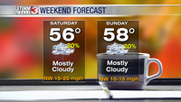
Tomorrow we are tracking similar weather conditions with highs in the upper 50s, with mostly cloudy skies and isolated showers. Winds will be gusty as well, with peak wind gusts of 10-15 miles per hour.

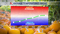
Looking ahead to the start of the work week, temperatures will start in the low 60s, with mostly sunny skies Monday and Tuesday. Wednesday, temperatures will be close to average, and hold at nearly average levels through Friday.

We are not tracking any chances for rain until late Thursday.