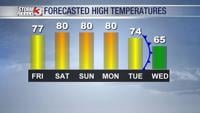
Very warm weather is expected through the weekend. Highs today will be in the upper 70s, but many will top 80º Saturday and Sunday.
Very warm weather is expected through the weekend. Highs today will be in the upper 70s, but many will top 80º Saturday and Sunday.

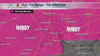
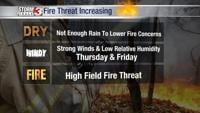
A RED FLAG (FIRE WEATHER) WARNING is in effect Thursday afternoon. Low relative humidity, very dry soil and vegetation, and a southwest breeze will bring a high fire threat.


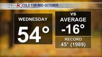
This afternoon, winds will remain from the west and northwest, keeping temperatures running around 15º below average for mid-October.

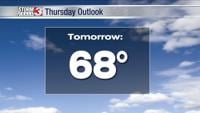
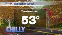
Wednesday brings more below average temperatures, but a warm-up is around the corner.

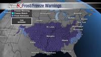
Brrr! Temperatures are below freezing this morning and the breeze is making it feel even colder with wind chills dipping back into the mid 20s.

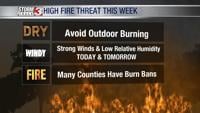
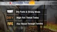
A Red Flag Warning is in effect Friday afternoon as low relative humidity and strong winds will bring a very high fire threat. Outdoor burning is discouraged.


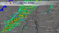
WSIL -- Wet Wednesday! Rain chances will ramp up throughout the morning with showers and occasional thunderstorms becoming likely across south…

WSIL -- Elevated fire threat over the next couple of days with strong winds from the northwest, low relative humidity, and dry vegetation. Bur…