The National Weather Service in Paducah has extended the

* Flash Flood Warning for...
Franklin County in south central Illinois...
Johnson County in southern Illinois...
Pulaski County in southern Illinois...
Williamson County in southern Illinois...

* Until 830 AM CDT.

* At 329 AM CDT, Doppler radar indicated thunderstorms producing
heavy rain across the warned area. Between 4 and 8 inches of rain
have fallen. Additional rainfall amounts of 1 to 2 inches are
possible in the warned area. Flash flooding is ongoing or expected
to begin shortly.

HAZARD...Flash flooding caused by thunderstorms.

SOURCE...Radar.

IMPACT...Flash flooding of small creeks and streams, urban
areas, highways, streets and underpasses as well as
other poor drainage and low-lying areas.

* Some locations that will experience flash flooding include...
Marion, Herrin, West Frankfort, Benton, Carterville, Johnston
City, Christopher, Vienna, Rend Lake Area, Sesser, Zeigler,
Crainville, Cambria, Royalton, Energy, Goreville, Mounds, Hurst,
Valier and West City.

PRECAUTIONARY/PREPAREDNESS ACTIONS...

Turn around, don't drown when encountering flooded roads. Most flood
deaths occur in vehicles.

Be especially cautious at night when it is harder to recognize the
dangers of flooding.

&&


FLASH FLOOD...RADAR INDICATED
Weather Alert
.The forecast of up to a foot of rain is on track, with many
locations nearing that total and experiencing widespread flooding.
Additional heavy rain will only exacerbate ongoing flooding and make
it even worse and more widespread.

...FLOOD WATCH REMAINS IN EFFECT THROUGH SUNDAY MORNING...

* WHAT...Flooding caused by excessive rainfall continues. Additional
heavy rains will only exacerbate ongoing flooding and make it
worse and more widespread...resulting in particularly dangerous
situations.

* WHERE...All of southeast Missouri, southern Illinois, southwest
Indiana, and western Kentucky.

* WHEN...Through Sunday morning.

* IMPACTS...Excessive runoff may result in flooding of rivers,
creeks, streams, and other low-lying and flood-prone locations.
Creeks and streams may rise out of their banks. Low-water
crossings may be flooded. Extensive street flooding and flooding
of creeks and rivers are possible. Area creeks and streams are
running high and could flood with more heavy rain. Be prepared as
rising water levels may cause particularly dangerous situations
where evacuations could become necessary.

* ADDITIONAL DETAILS...
- Flash flooding and flooding caused by excessive rainfall is
expected. With the forecast on track and radar estimates and
spotter reports confirming many locations already having
received between 4 and 10 inches, anticipated additional
bouts of heavy rain will put everyone in the half foot to
foot range. A few isolated totals greater than a foot are not
out of the question. These amounts and resultant flooding
creates a particularly dangerous situation.


PRECAUTIONARY/PREPAREDNESS ACTIONS...

Monitor the latest forecasts and be alert for additional Flash Flood
and Flood Warnings. Those living in areas prone to flooding should
be prepared to take action should flooding develop or worsen.

&&
Weather Alert
...The Flood Warning is extended for the following rivers in
Illinois...

Big Muddy River near Plumfield affecting Williamson and Franklin
Counties.

Big Muddy River near Murphysboro affecting Jackson County.

.A couple more rounds of moderate to heavy rain can be expected into
the weekend. The rest of the event rainfall has been incorporated
into the river forecast.  The Big Muddy River has started to rise and
crests are expected over the next week. Now is the time to prepare
for flooding.

PRECAUTIONARY/PREPAREDNESS ACTIONS...

Motorists should not attempt to drive around barricades or drive
cars through flooded areas.

Caution is urged when walking near riverbanks.

Be especially cautious at night when it is harder to recognize the
dangers of flooding.

Turn around, don't drown when encountering flooded roads. Most flood
deaths occur in vehicles.

Additional information is available at www.weather.gov.

&&

...FLOOD WARNING NOW IN EFFECT FROM SATURDAY AFTERNOON UNTIL FURTHER
NOTICE...

* WHAT...Moderate flooding is forecast.

* WHERE...Big Muddy River near Plumfield.

* WHEN...From Saturday afternoon until further notice.

* ADDITIONAL DETAILS...
- At 9:30 PM CDT Friday the stage was 14.9 feet.
- Forecast...The river is expected to rise above flood stage
early tomorrow afternoon and continue rising to a crest of
27.1 feet early Monday afternoon.
- Flood stage is 20.0 feet.
- http://www.weather.gov/safety/flood

&&
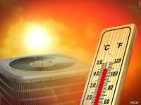
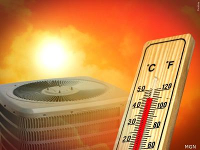
CARTERVILLE, Ill. -- is advising ways for residents to keep cool during the summer heat.
Here is a list of ways to stay healthy and ways to stay cool...
Download the free WSIL News and Weather apps for the latest stories and alerts sent straight to your mobile device. You may also see us on for the latest videos.